Hebi facts for kids
Quick facts for kids
Hebi
鹤壁市
Hopi
|
|
|---|---|
|
Prefecture-level city
|
|
|
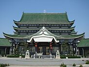
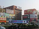
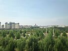
From top, left to right: Temple of the Eight Symbols in Qi County; Pagoda in Xun County; Shancheng District Department Store; View near Hebi East railway station
|
|
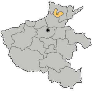
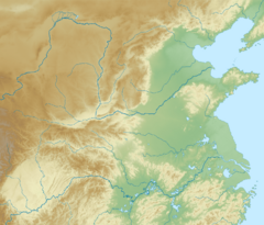
Location of Hebi in Henan
|
|
| Country | People's Republic of China |
| Province | Henan |
| Municipal seat | Qibin District |
| Area | |
| • Prefecture-level city | 2,299 km2 (888 sq mi) |
| • Urban
(2018)
|
543 km2 (210 sq mi) |
| • Metro | 847.3 km2 (327.1 sq mi) |
| Population
(2020 census for total, 2018 otherwise)
|
|
| • Prefecture-level city | 1,565,973 |
| • Density | 681.15/km2 (1,764.2/sq mi) |
| • Urban
(2018)
|
667,600 |
| • Urban density | 1,229.5/km2 (3,184/sq mi) |
| • Metro | 574,000 |
| • Metro density | 677.4/km2 (1,754.6/sq mi) |
| GDP | |
| • Prefecture-level city | CN¥ 77.2 billion US$ 11.6 billion |
| • Per capita | CN¥ 47,940 US$ 7,217 |
| Time zone | UTC+8 (China Standard) |
| Area code(s) | 392 |
| ISO 3166 code | CN-HA-06 |
| Major Nationalities | Han |
| County-level divisions | 5 |
| Township-level divisions | unknown |
| License plate prefixes | 豫F |
Hebi (simplified Chinese: 鹤壁; traditional Chinese: 鶴壁; pinyin: Hèbì) is a city in northern Henan province, China. It sits among mountains at the edge of the Shanxi plateau. Hebi is about 40 kilometers (25 miles) south of Anyang and 65 kilometers (40 miles) northeast of Xinxiang.
In 2020, Hebi had a population of over 1.5 million people. A large part of the city, including Qibin District and Qi County, is a connected urban area.
Hebi is known for its coal mines. It also has a special area called Hebi New Area, which is designed to help the city's economy grow.
City Administration
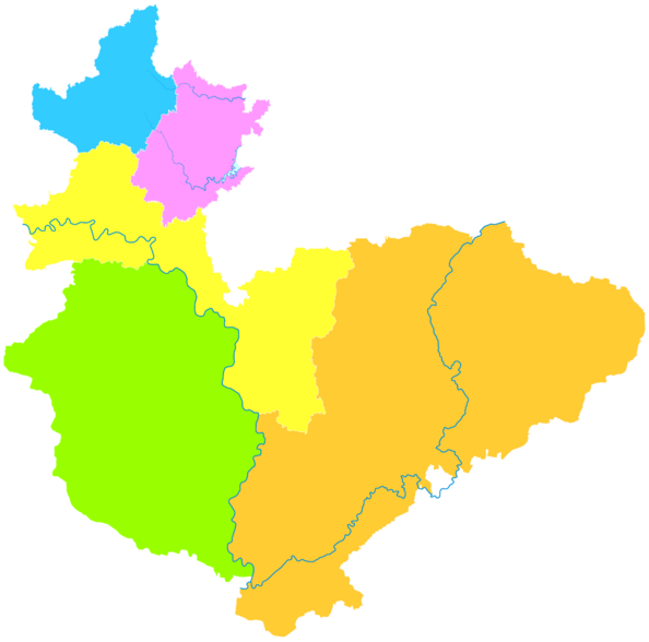
The city of Hebi is divided into different areas to help manage it. It has 3 districts and 2 counties. Think of these like smaller towns or regions within the main city.
- Qibin District (淇滨区)
- Shancheng District (山城区)
- Heshan District (鹤山区)
- Xun County (浚县)
- Qi County (淇县)
| Map of Hebi's Divisions |
|---|
Heshan
Shancheng
Qibin
Xun
County Qi
County |
Hebi's Climate
Hebi has a climate with clear seasons. Summers are hot and wet, while winters are cold and dry. Most of the rain falls during July and August.
| Climate data for Hebi (2010–2020 normals) | |||||||||||||
|---|---|---|---|---|---|---|---|---|---|---|---|---|---|
| Month | Jan | Feb | Mar | Apr | May | Jun | Jul | Aug | Sep | Oct | Nov | Dec | Year |
| Mean daily maximum °C (°F) | 4.3 (39.7) |
8.0 (46.4) |
15.2 (59.4) |
20.7 (69.3) |
27.0 (80.6) |
32.7 (90.9) |
32.5 (90.5) |
30.5 (86.9) |
27.0 (80.6) |
21.3 (70.3) |
13.1 (55.6) |
6.7 (44.1) |
19.9 (67.9) |
| Daily mean °C (°F) | −1.4 (29.5) |
1.8 (35.2) |
8.7 (47.7) |
14.5 (58.1) |
20.9 (69.6) |
26.2 (79.2) |
27.3 (81.1) |
25.6 (78.1) |
20.7 (69.3) |
15.1 (59.2) |
7.5 (45.5) |
0.5 (32.9) |
13.9 (57.1) |
| Mean daily minimum °C (°F) | −6.0 (21.2) |
−3.1 (26.4) |
2.7 (36.9) |
8.4 (47.1) |
14.7 (58.5) |
20.1 (68.2) |
23.0 (73.4) |
21.6 (70.9) |
15.8 (60.4) |
10.2 (50.4) |
2.9 (37.2) |
−4.2 (24.4) |
8.8 (47.9) |
| Average precipitation mm (inches) | 6.1 (0.24) |
8.2 (0.32) |
5.9 (0.23) |
42.3 (1.67) |
36.8 (1.45) |
65.1 (2.56) |
155.1 (6.11) |
133.9 (5.27) |
64.3 (2.53) |
24.2 (0.95) |
23.4 (0.92) |
3.4 (0.13) |
568.7 (22.38) |
| Average precipitation days (≥ 0.1 mm) | 2.3 | 2.3 | 2.7 | 5.8 | 6.4 | 7.0 | 10.3 | 9.9 | 7.6 | 5.7 | 5.7 | 1.4 | 67.1 |
| Average relative humidity (%) | 62 | 60 | 59 | 67 | 66 | 59 | 76 | 82 | 78 | 69 | 70 | 65 | 68 |
| Source: China Meteorological Administration | |||||||||||||
History of Hebi
The name "Hebi" first appeared in an old book called "History of Jin". People believe that long ago, cranes (a type of bird) would rest on the cliffs of the southern mountains. Because of this, the southern mountain was named 鹤山 (HeShan), which means "Crane Mountain." The village nearby was then called 鹤壁 (Hebi), meaning "Cranes resting on cliffs."
Moving the City Center
The main urban area of Hebi has moved three times!
- First Move (1957): In 1957, the city center was first set up in a place called Hebiji.
- Second Move (1957): Later that year, as new mines were built, the city center moved south to what is now Zhongshan District.
- Third Move (1959): In 1959, the center moved again to an area known as Dahu. However, the land around Dahu started to sink because of mining. This made it hard for the city to grow.
- New Center (1992-1999): So, in 1992, the Hebi government created a new development zone in the southeast, called Qibin. This area grew quickly, and by May 1999, Qibin District became the new main center for politics and business in Hebi City.
See also
 In Spanish: Hebi para niños
 | Bessie Coleman |
 | Spann Watson |
 | Jill E. Brown |
 | Sherman W. White |


