
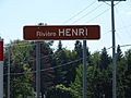
Henri River (Lotbinière) facts for kids
Quick facts for kids Henri River |
|
|---|---|

|
|
| Native name | Rivière Henri |
| Country | Canada |
| Province | Quebec |
| Region | Chaudière-Appalaches |
| MRC | Lotbinière Regional County Municipality |
| Physical characteristics | |
| Main source | Agricultural and forest streams Saint-Gilles 151 metres (495 ft) 46°29′33″N 71°47′10″W / 46.4925°N 71.78611°W |
| River mouth | Rivière du Chêne Bécancour 70 metres (230 ft) 46°29′33″N 71°47′08″W / 46.49258°N 71.78551°W |
| Length | 50.1 kilometres (31.1 mi) |
| Basin features | |
| River system | St. Lawrence River |
| Tributaries |
|
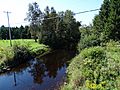
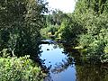
The Henri River (called rivière Henri in French) is a river in Quebec, Canada. It's like a smaller stream that flows into a bigger river called the Rivière du Chêne. The Rivière du Chêne then empties into the huge St. Lawrence River. The Henri River flows through several towns. These include Saint-Gilles, Sainte-Agathe-de-Lotbinière, Dosquet, Saint-Janvier-de-Joly, Val-Alain, and Leclercville. All these towns are in the Lotbinière Regional County Municipality area of Quebec.
Contents
River's Journey
Where the Henri River Starts
The Henri River begins in a marshy, forest area. This spot is in the southern part of Saint-Gilles. It's like the river's "head" or source. This starting point is about 5.6 kilometers northeast of Sainte-Agathe-de-Lotbinière. It's also 9.2 kilometers west of Saint-Patrice-de-Beaurivage.
How the River Flows
The Henri River flows for about 50.1 kilometers. As it travels, it drops about 81 meters in elevation. This means it flows downhill from its source to where it meets another river.
The river's journey can be thought of in two main parts:
Upper Part of the River
In its upper part, the Henri River flows mostly northwest. It crosses between Saint-Gilles and Sainte-Agathe-de-Lotbinière. It also crosses Route 218. The river then turns west and north, still within Sainte-Agathe-de-Lotbinière. It then heads northeast in Saint-Gilles. Later, it flows westward towards Dosquet. Near Dosquet, it crosses Route 271 and Route 116.
Lower Part of the River
After crossing Route 116, the Henri River continues its journey westward. It flows towards Joly and then Val-Alain. Along this path, it crosses a few country roads. It also goes under Highway 20. The river then winds its way north, eventually reaching the border between Val-Alain and Leclercville.
Where the River Ends
Finally, the Henri River empties into the Rivière du Chêne. This happens on the east bank of the Rivière du Chêne. This meeting point is known as "Les Trois-Fourches."
Nearby Rivers
The Henri River is part of a larger system of rivers. Here are some of the rivers near it:
- To the north: Aulneuse River, rivière aux Cèdres, rivière aux Frênes, Huron River, Noire River (Huron River tributary), and the St. Lawrence River.
- To the east: Jean-Houde River, Beaurivage River, Rouge River, Noire River, and Saint-Georges River.
- To the south: Rivière du Chêne and Armagh River.
- To the west: Rivière du Chêne.
River's Name
The name "Rivière Henri" was officially recognized on December 5, 1968. This was done by the Commission de toponymie du Québec. This commission is in charge of naming places in Quebec.
Images for kids
-
Henri River
-
Henri River
-
Sign
.jpg)
.jpg)
.jpg)
