Heritage Hills, Colorado facts for kids
Quick facts for kids
Heritage Hills, Colorado
|
|
|---|---|

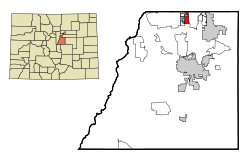
Location of Heritage Hills in Douglas County, Colorado.
|
|
| Country | |
| State | |
| County | Douglas County |
| City | City of Lone Tree |
| Elevation | 5,915 ft (1,803 m) |
| Population
(2000)
|
|
| • Total | 658 |
| Time zone | UTC-7 (MST) |
| • Summer (DST) | UTC-6 (MDT) |
| ZIP code |
Lone Tree 80124
|
| Area codes | 303 & 720 |
| GNIS feature | Heritage Hills, Colorado |
Heritage Hills is a lovely neighborhood located in the city of Lone Tree, Colorado. It's part of Douglas County, Colorado, in the beautiful state of Colorado, United States.
Years ago, Heritage Hills was known as a "census-designated place" (CDP). This means it was an area identified by the government for counting people. It wasn't officially a city or town on its own.
In the year 2000, about 658 people lived here. The local mail for Heritage Hills comes through the Lone Tree Post Office, using the ZIP code 80124.
Where is Heritage Hills?
Heritage Hills is found in a specific spot in Colorado. Its exact location can be described using special numbers called coordinates. These are like an address on a map.
The coordinates for Heritage Hills are 39°32′35″N 104°52′44″W / 39.543°N 104.879°W. The first number, 39.543, tells you how far north it is. The second number, -104.879, tells you how far west it is.
This neighborhood is located in Douglas County, Colorado. It is also considered part of the larger Denver metropolitan area. This means it's near the big city of Denver and its surrounding towns.
See also
- In Spanish: Heritage Hills (Colorado) para niños

