Herndon, Kansas facts for kids
Quick facts for kids
Herndon, Kansas
|
|
|---|---|

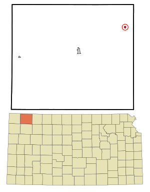
Location within Rawlins County and Kansas
|
|

|
|
| Country | United States |
| State | Kansas |
| County | Rawlins |
| Founded | 1878 |
| Incorporated | 1906 |
| Named for | William Herndon |
| Area | |
| • Total | 0.32 sq mi (0.82 km2) |
| • Land | 0.32 sq mi (0.82 km2) |
| • Water | 0.00 sq mi (0.00 km2) |
| Elevation | 2,671 ft (814 m) |
| Population
(2020)
|
|
| • Total | 119 |
| • Density | 372/sq mi (145.1/km2) |
| Time zone | UTC-6 (CST) |
| • Summer (DST) | UTC-5 (CDT) |
| ZIP code |
67739
|
| Area code | 785 |
| FIPS code | 20-31475 |
| GNIS ID | 2394363 |
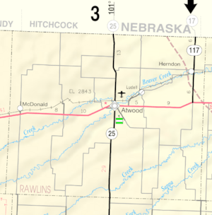
Herndon is a small city located in Rawlins County, Kansas, in the United States. In 2020, about 119 people lived there. It is located approximately 12.5 miles (20 km) south of the Kansas-Nebraska state border.
Contents
History of Herndon
Herndon was first founded in 1878 and was originally named Pesth. This name came from Pest, a city in Hungary that later joined with Buda to become Budapest.
In 1879, the town's name was changed to Herndon. This new name honored William H. Herndon, who was a law partner of Abraham Lincoln, a famous American president. Herndon officially became an incorporated city in 1906.
Geography and Area
According to the United States Census Bureau, the city of Herndon covers a total area of about 0.26 square miles (0.67 square kilometers). All of this area is land.
Population Changes Over Time
| Historical population | |||
|---|---|---|---|
| Census | Pop. | %± | |
| 1910 | 273 | — | |
| 1920 | 411 | 50.5% | |
| 1930 | 430 | 4.6% | |
| 1940 | 443 | 3.0% | |
| 1950 | 321 | −27.5% | |
| 1960 | 339 | 5.6% | |
| 1970 | 268 | −20.9% | |
| 1980 | 220 | −17.9% | |
| 1990 | 170 | −22.7% | |
| 2000 | 149 | −12.4% | |
| 2010 | 129 | −13.4% | |
| 2020 | 119 | −7.8% | |
| U.S. Decennial Census | |||
The population of Herndon has changed quite a bit over the years. In 1910, there were 273 people living in the city. The population grew to its highest point in 1940 with 443 residents. Since then, the number of people living in Herndon has slowly decreased. By 2020, the population was 119.
In 2020, there were 55 households in Herndon. Many households (45.5%) had only one person living there. The average household size was about 1.6 people. The median age in the city was 44.5 years, meaning half the population was older than 44.5 and half was younger.
Fun Local Events
Herndon is known for a special event called the Herndon Ox Roast. This big celebration happens every five years.
The day starts with a parade, followed by a delicious lunch of pit-smoked beef. There's also live music, a fun game called cow patty bingo, and even an outhouse race! The day ends with a street dance on Main Street. Thousands of people come to Herndon for this exciting event.
Education in Herndon
The public schools in Herndon are part of the Rawlins County USD 105 school district. This district was created in 2003 when the Herndon and Atwood school districts joined together.
Students living in Herndon now attend school in the nearby town of Atwood. They go to Rawlins County Elementary School and Rawlins County Junior-Senior High School. Herndon High School, whose mascot was the Herndon Beavers, closed in 2004 as part of the school unification.
Famous Person from Herndon
One notable person from Herndon is Rudolph Wendelin. He was a talented artist for the Forest Service and is famous for creating the well-known character, Smokey Bear.
See also
 In Spanish: Herndon (Kansas) para niños
 | May Edward Chinn |
 | Rebecca Cole |
 | Alexa Canady |
 | Dorothy Lavinia Brown |

