Hertford Union Canal facts for kids
Quick facts for kids Hertford Union Canal |
|
|---|---|

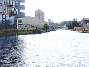
Junction of Hertford Union Canal and River Lee Navigation
|
|
| Specifications | |
| Maximum boat length | 72 ft 0 in (21.95 m) |
| Maximum boat beam | 14 ft 0 in (4.27 m) |
| Locks | 3 |
| Status | Navigable |
| Navigation authority | Canal and River Trust |
| History | |
| Original owner | Sir George Duckett |
| Principal engineer | Francis Giles |
| Date of act | 1824 |
| Date completed | 1830 |
| Geography | |
| Start point | Regent's Canal |
| End point | Lee Navigation |
The Hertford Union Canal, also known as Duckett's Cut, is a waterway in East London. It's just over 1.6 kilometers (1 mile) long. This canal connects the Regent's Canal to the River Lee Navigation. It opened in 1830 but didn't become a big business success right away. Later, it became part of the Grand Union Canal network.
Contents
The Story of the Hertford Union Canal
The Hertford Union Canal was built to create a shortcut for boats. It allowed boats travelling on the River Lee Navigation to reach the River Thames more easily. Before this canal, boats had to use the Bow Back Rivers. These rivers were often tricky to navigate because they were tidal and sometimes filled with mud. The new canal offered a quicker path to the Thames and to places west along the Regent's Canal.
Sir George Duckett was the person who pushed for this canal to be built. He managed to get a special law passed by Parliament on May 17, 1824. This law allowed him to build the canal and charge money for boats to use it.
The canal officially opened in 1830. For a while, people called it Duckett's Canal or Duckett's Cut, named after Sir George. However, it didn't make much money. Within a year, they were even offering free use to try and attract boats! For several years around the 1850s, boats couldn't even use it. A dam was built across it to stop water from the Regent's Canal from flowing into it.
After some attempts to sell it, the Regent's Canal Company bought it on October 28, 1857. The new owners fixed it up, removing the dam and making the canal deeper and wider. When the Grand Union Canal Company was formed in 1929, the Hertford Union Canal became part of their large network. Today, the Canal & River Trust takes care of it.
Exploring the Canal's Path
The Hertford Union Canal begins at a place called Hertford Union Junction. This spot is between Mile End Lock and Old Ford Lock on the Regent's Canal.
As you follow the canal, it goes past the north side of Bow Wharf. This area was updated in the 1990s and now has shops and places to eat. After passing under Grove Road, the canal runs south of the Lakeview Estate, which was built in 1958. For most of the rest of its journey, the canal runs along the south edge of Victoria Park. The canal then joins the River Lee Navigation just above Old Ford Lock.
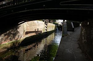
Many of the old bridges, locks, and other structures along the canal are very old. They were built when the canal first opened in 1830. These structures are now protected as important historical sites.
How Boats Go Up and Down: The Locks
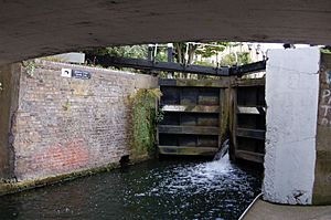
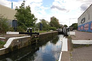
Canal locks are like water elevators for boats. They help boats move between different water levels. The Hertford Union Canal has three locks, all located near each other in the area called Old Ford. They are known as Hertford Union Top, Middle, and Bottom locks.
These three locks lower boats about 5.8 meters (19 feet) from the Regent's Canal down to the Lee Navigation. They are all single locks, meaning only one boat can go through at a time. The biggest boats that can use these locks are about 22 meters (72 feet) long and 4.2 meters (14 feet) wide.
Let's look at each lock as you travel from west to east:
Hertford Union Top Lock (No. 1)
This is the first lock you'll reach, about 1 kilometer (0.63 miles) from the junction with the Regent's Canal. It's located just south of Victoria Park. The end of the lock goes under a metal footbridge that leads into the park from Parnell Road. This lock lowers the water level by about 1.9 meters (6 feet 3 inches).
This lock was made a "Grade II listed structure" in 1990. This means it's an important historical building. Its bottom gates have special cast iron beams that are quite rare. One of the small houses next to the lock (No 3 Lock Cottages) is also a protected historical building.
Hertford Union Middle Lock (No. 2)
The middle lock lowers the water level by about 2.7 meters (8 feet 11 inches). The end of this lock passes under Cadogan Terrace.
Hertford Union Bottom Lock (No. 3)
The lowest lock drops the water level by about 1.1 meters (3 feet 9 inches). It's very close to where the canal joins the River Lee, only about 0.2 kilometers (0.13 miles) away.
Getting Around the Canal
The path next to the canal, called the towpath, is open for people to walk and cycle on. You don't need a special pass. At its eastern end, the towpath connects to the Lea Valley Walk, which is a long walking trail.
Near Hackney Wick, another walking route called the Capital Ring crosses the canal. Section 13 of this route goes northwest towards Stoke Newington. Section 14 goes southeast, using The Greenway towards Beckton District Park.
The Hertford Union Canal towpath is also part of a popular walking loop called the "Limehouse Circuit." This five-mile walk starts at Limehouse Basin and uses the Limehouse Cut, Lee Navigation, Regent's Canal, and the Hertford Union Canal to make a full circle.
The Queen Elizabeth Olympic Park was built just east of the Lee Navigation. During the 2012 Summer Olympics, the Hertford Union Canal was closed to regular boats. It was used for boats visiting the games. After the Olympics, there were plans to improve access to the Olympic Park and the Bow Back Rivers from the canal.
 | Toni Morrison |
 | Barack Obama |
 | Martin Luther King Jr. |
 | Ralph Bunche |


