Hettesheimer Run facts for kids
Quick facts for kids Hettesheimer Run |
|
|---|---|

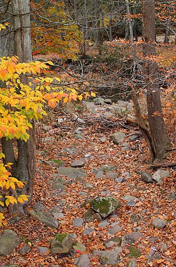
Hettesheimer Run near its mouth
|
|
| Other name(s) | Hettesheimer's Run |
| Physical characteristics | |
| Main source | valley to the west of Schooley Mountain in Noxen Township, Wyoming County, Pennsylvania between 1,520 and 1,540 feet (463 and 469 m) |
| River mouth | Bowman Creek in Noxen in Noxen Township, Wyoming County, Pennsylvania 1,004 ft (306 m) 41°25′37″N 76°03′52″W / 41.42689°N 76.06451°W |
| Length | 1.6 mi (2.6 km) |
| Basin features | |
| Progression | Bowman Creek → Susquehanna River → Chesapeake Bay |
| Basin size | 1.94 sq mi (5.0 km2) |
Hettesheimer Run (also known as Hettesheimer's Run) is a small stream in Wyoming County, Pennsylvania. It flows into Bowman Creek. The stream is about 1.6 miles (2.6 km) long. It runs through Noxen Township.
The area of land that drains into Hettesheimer Run is about 1.94 square miles (5.0 km2). This stream is considered a healthy waterway. It is known for its high-quality cold water. Many fish, including wild trout, live here.
Contents
Where Hettesheimer Run Flows
Hettesheimer Run starts in a valley. This valley is west of Schooley Mountain in Noxen Township. The stream first flows southeast through this valley.
After a while, it turns to flow south-southeast. Then, it turns again to flow south-southwest. At this point, it enters the town of Noxen. The stream then leaves its valley. It soon meets and joins Bowman Creek.
Hettesheimer Run joins Bowman Creek about 13.84 miles (22.27 km) before Bowman Creek reaches its own end.
Water Quality of the Stream
Hettesheimer Run is a very clean stream. It is not listed as a polluted or "impaired" waterbody. This means its water quality is good. The water has a certain level of alkalinity, which is about 12 milligrams per liter (0.012 oz/cu ft). This helps keep the water healthy for plants and animals.
Land Around the Stream
The land near where Hettesheimer Run meets Bowman Creek is about 1,004 feet (306 m) above sea level. The stream begins much higher up. Its starting point is between 1,520 and 1,540 feet (463 and 469 m) above sea level.
The ground around the stream's mouth has different types of soil. These include alluvium, which is soil left by flowing water. Further upstream, the land along the stream is also made of alluvium. There is also a type of soil called Wisconsinan Till. This was left behind by glaciers. In the middle and upper parts of the stream, the land is mostly Wisconsinan Till. However, near the stream's valley, you can find solid bedrock. This bedrock is made of sandstone and shale.
The Stream's History
Hettesheimer Run was officially named on August 2, 1979. It is also known by the name Hettesheimer's Run.
An old Native American site was found near where Hettesheimer Run joins Bowman Creek. It might have been a rock shelter.
In the early 1900s, people used Hettesheimer Run for water. It supplied water for industries in Noxen. Around the same time, the Department of Fisheries closed parts of the stream. This was likely to protect the fish.
In 2005, the Pennsylvania Fish and Boat Commission talked about adding Hettesheimer Run to a special list. This list is for streams that have "Class A Wild Trout Waters."
Animals and Plants
The area around Hettesheimer Run is very important for wildlife. It is known as a High-Quality Coldwater Fishery. This means it's a great place for fish that like cold water. It's also a Migratory Fishery, which means fish that travel long distances use it.
Wild trout naturally live and reproduce in Hettesheimer Run. You can find them from the very start of the stream all the way to its end. The Pennsylvania Fish and Boat Commission officially calls it "Class A Wild Trout Waters." This is because it has healthy populations of brook trout.
In 1956, a type of snake called Diadophis punctatus edwardsii was seen near Hettesheimer Run. This shows the area is home to different kinds of animals.
 | Aaron Henry |
 | T. R. M. Howard |
 | Jesse Jackson |

