Hildburghausen Rural District facts for kids
Quick facts for kids
Landkreis Hildburghausen
|
|
|---|---|
 |
|
| Country | |
| State | Thuringia |
| Capital | Hildburghausen |
| Area | |
| • Total | 937 km2 (362 sq mi) |
| Population
(2002)
|
|
| • Total | 72,800 |
| • Density | 77.69/km2 (201.23/sq mi) |
| Time zone | UTC+1 (CET) |
| • Summer (DST) | UTC+2 (CEST) |
| Vehicle registration | HBN |
| Website | landkreis-hildburghausen.de |
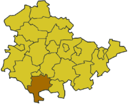
Hildburghausen is a district located in the state of Thuringia, Germany. A district is like a county or a region that has its own local government. This area used to be part of an old duchy called Saxe-Hildburghausen. A duchy was a territory ruled by a duke or duchess a long time ago.
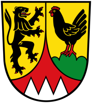
What is the Coat of Arms?

The coat of arms is like a special symbol or emblem for the Hildburghausen district. It tells a story about the area's history.
- The lion you see is the heraldic lion of Meißen. This symbol represents a powerful historical region in Germany.
- The cock (a rooster) stands for the counts of Henneberg. These counts were important rulers in this region until the year 1583.
- Below these symbols, you can see the sign of the bishopric of Würzburg. This shows that the church and its leaders had an influence here in the past.
Towns and Communities
The Hildburghausen district is made up of several towns and many smaller communities. These places work together to manage the district.
Some of the main towns in the district include:
There are also many other smaller towns and villages. Some of these communities group together to share services. These groups are called Verwaltungsgemeinschaften in German. It means "administrative communities."
Related Pages
 | William Lucy |
 | Charles Hayes |
 | Cleveland Robinson |

