Hillsborough River (Prince Edward Island) facts for kids
The Hillsborough River, also called the East River, is a Canadian river. You can find it in the northeastern part of Queens County, on Prince Edward Island.
Contents
A Look Back in Time
The Battle at Port-la-Joye
Long ago, during a conflict called King George's War, soldiers from New England captured Île Saint-Jean (which is now Prince Edward Island). They had two warships and about 200 soldiers stationed at a place called Port-La-Joye.
To try and get Acadia back, a French officer named Ramezay was sent from Quebec. He wanted to team up with another French group. First, he sent another officer, Boishébert, to Île Saint-Jean to see how many New England soldiers were there.
After Boishébert returned, Ramezay sent Joseph-Michel Legardeur de Croisille et de Montesson with over 500 men. About 200 of these men were Mi'kmaq warriors. In July 1746, they fought a battle near what is now the Hillsborough River. Montesson and his troops won, capturing or killing forty New England soldiers. This was a big success for Montesson in his first independent command.
Acadians Settle and Leave
Records from 1752 show that Acadians arrived at the Northeast River (today's Hillsborough River) in 1750. An important Acadian, Joseph-Nicolas Gautier, moved his family from Annapolis Royal to the River North-East, near what is now Scotchfort.
Other families, like Jean Pitre's, also came from Nova Scotia. They were part of the Acadian Exodus, moving to escape problems after Protestants arrived in Nova Scotia and the city of Halifax was started in 1749.
Sadly, during the French and Indian War in 1758, the entire Acadian community living along the Hillsborough River faced a terrible event. They were forced to leave their homes. Many were put on a ship called the Duke William, which later sank in the English Channel. This was a very sad event in Canadian history.
River Features and Connections
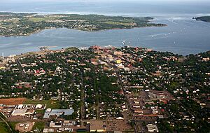
The Hillsborough River starts near a small farming area called Head of Hillsborough. It flows southwest and becomes a wide, tidal area called an estuary near Mount Stewart. This estuary gets wider and wider, reaching about 1 kilometer (0.6 miles) wide where it flows into Charlottetown Harbour.
The river is about 45 kilometers (28 miles) long in total. About 12 kilometers (7.5 miles) of this length is the wide estuary.
The Hillsborough River was the 27th river in Canada to be recognized as a Canadian Heritage Rivers System river. It was the first one in Prince Edward Island! The river's estuary passes by old farming communities, special Acadian dykes (walls to hold back water), historic shipyards, and the Charlottetown waterfront. This is where the Fathers of Confederation landed a long time ago. The part of the river that is fresh water flows through beautiful forests, farms, and large wetlands.
Bridges Over the River
Years ago, the Prince Edward Island Railway built a huge bridge over the Hillsborough River. This bridge connected Charlottetown and Southport. It was one of the longest railway bridges in eastern Canada and one of the longest narrow-gauge railway bridges in the world! There was also a shorter railway bridge in Mount Stewart.
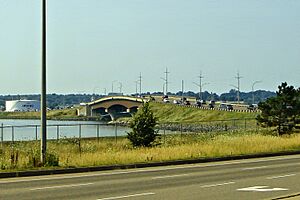
A modern highway bridge was built next to the big railway bridge in 1962. It was made even bigger and better in 1995. Other highway bridges cross the river in Mount Stewart and further upstream.
Fun and Challenges
People enjoy many activities on the Hillsborough River, like boating and fishing. There are also important fisheries for quahogs and oysters.
However, the river faces some challenges. It has high levels of nitrates and a lot of silt (muddy soil) running into it. This often happens because of too much farming and building near the riverbanks.
 | Victor J. Glover |
 | Yvonne Cagle |
 | Jeanette Epps |
 | Bernard A. Harris Jr. |


