Hokonui Hills facts for kids
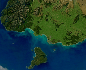
The Hokonui Hills are a group of hills in the middle of Southland, New Zealand. People sometimes call them The Hokonui Mountains or just The Hokonui. These hills stand about 600 metres (nearly 2,000 feet) above the flat lands around them, known as the Southland Plains. They mark the northern edge of these plains.
About the Hokonui Hills
The Hokonui Hills are an important part of the Southland landscape. They cover a large area, about 1,200 square kilometres (460 square miles). This is roughly the size of a big city! The hills are located in a triangle formed by three towns: Gore to the east, Lumsden to the north, and Winton to the southwest.
How the Hokonui Hills Formed
The Hokonui Hills are part of something called the Southland Syncline. Imagine a giant blanket that has been folded up. In geology, a "fold" is when layers of rock bend and curve. The Southland Syncline is a huge geological fold system. It stretches from the coast at The Catlins and goes northwest.
Over millions of years, the Earth's huge plates, called tectonic plates, have been moving. New Zealand sits on the edge of two of these plates. A special kind of crack in the Earth's crust, called a transform fault, helped create the Southern Alps. This fault also caused part of the Southland Syncline to move far north. This moved section now includes hills found in Kahurangi National Park, which is in the northwest of the South Island.
Rivers and Plains
The Hokonui Hills act like a natural divider for the Southland Plains. To the north and east of the hills, you'll find the wide floodplain of the Mataura River. This is a flat area that can sometimes be covered by river water.
To the south and west of the Hokonui Hills, the plains of the Aparima River and Oreti River stretch out. A main branch of the Oreti River, called the Makarewa River, actually starts in the southern part of the Hokonui Hills. So, these hills play a role in where some of Southland's important rivers begin their journey.
 | Georgia Louise Harris Brown |
 | Julian Abele |
 | Norma Merrick Sklarek |
 | William Sidney Pittman |


