
Holly, Colorado facts for kids
Quick facts for kids
Holly, Colorado
|
|
|---|---|

Former Holly Santa Fe Depot, currently is town hall (2010)
|
|

Location with Prowers County and Colorado
|
|
| Country | United States |
| State | Colorado |
| County | Prowers |
| Incorporated | September 4, 1903 |
| Area | |
| • Total | 0.7244 sq mi (1.8763 km2) |
| • Land | 0.7234 sq mi (1.8737 km2) |
| • Water | 0.0010 sq mi (0.0026 km2) |
| Elevation | 3,396 ft (1,035 m) |
| Population
(2020)
|
|
| • Total | 837 |
| • Density | 1,155.4/sq mi (446.09/km2) |
| Time zone | UTC−7 (MST) |
| • Summer (DST) | UTC−6 (MDT) |
| ZIP Code |
81047
|
| Area code | 719 |
| FIPS code | 08-37215 |
| GNIS ID | 2412764 |
Holly is a small town in Prowers County in southeastern Colorado, United States. It is a "statutory town," which means it follows certain rules set by the state. Holly is located about 4.3 miles (7 km) west of the Kansas border.
Even though Colorado is known for its high mountains, Holly is the lowest town in the state, at an elevation of 3,393 feet (1,034 meters). However, this is still higher than the highest points in 19 other U.S. states! In 2020, about 837 people lived in Holly.
Contents
History
How Holly Started
Holly began as a community for ranching. It officially became a town in 1903. The town was named after Hiram S. Holly, a local cattle rancher. Hiram S. Holly moved to the area in 1871 and brought 1,300 cattle with him. His ranch, called the SS Ranch, was the first settlement in this area.
The Holly SS Ranch Barn, a stone barn built in 1879, is still standing today. It is listed on the National Register of Historic Places, which means it's an important historical site. The original stone ranch house is also still there, but it's not on the list.
Holly Sugar Company
The Holly Sugar company was started in the town of Holly in 1905. It began just in time for the sugarbeet harvest that year. The company was very successful at making sugar from sugarbeets. Because it did so well, Holly Sugar quickly decided to grow and open factories in other communities. By 1911, the company had expanded outside of Colorado. The Holly Sugar company is no longer in the town of Holly. In 1988, it joined with another company called Imperial Sugar.
Geography
Holly is a small town with a total area of about 0.72 square miles (1.87 square kilometers). Most of this area is land, with a very small amount of water.
Climate
The weather in Holly is classified as a semi-arid climate. This means it's usually dry, but not a desert. It gets some rain, but not a lot.
| Climate data for Holly, Colorado (1991–2020 normals, extremes 1900–present) | |||||||||||||
|---|---|---|---|---|---|---|---|---|---|---|---|---|---|
| Month | Jan | Feb | Mar | Apr | May | Jun | Jul | Aug | Sep | Oct | Nov | Dec | Year |
| Record high °F (°C) | 79 (26) |
88 (31) |
96 (36) |
99 (37) |
107 (42) |
111 (44) |
110 (43) |
109 (43) |
105 (41) |
97 (36) |
90 (32) |
81 (27) |
111 (44) |
| Mean maximum °F (°C) | 67.0 (19.4) |
73.8 (23.2) |
83.1 (28.4) |
89.9 (32.2) |
96.8 (36.0) |
102.6 (39.2) |
104.4 (40.2) |
102.0 (38.9) |
98.5 (36.9) |
91.1 (32.8) |
79.0 (26.1) |
66.8 (19.3) |
105.5 (40.8) |
| Mean daily maximum °F (°C) | 45.7 (7.6) |
49.7 (9.8) |
60.2 (15.7) |
68.3 (20.2) |
77.9 (25.5) |
89.1 (31.7) |
93.4 (34.1) |
90.6 (32.6) |
83.1 (28.4) |
70.5 (21.4) |
57.0 (13.9) |
46.2 (7.9) |
69.3 (20.7) |
| Daily mean °F (°C) | 30.5 (−0.8) |
33.9 (1.1) |
43.2 (6.2) |
51.3 (10.7) |
61.8 (16.6) |
72.7 (22.6) |
78.1 (25.6) |
75.7 (24.3) |
67.1 (19.5) |
53.7 (12.1) |
40.6 (4.8) |
30.7 (−0.7) |
53.3 (11.8) |
| Mean daily minimum °F (°C) | 15.3 (−9.3) |
18.1 (−7.7) |
26.3 (−3.2) |
34.3 (1.3) |
45.8 (7.7) |
56.2 (13.4) |
62.7 (17.1) |
60.9 (16.1) |
51.0 (10.6) |
36.9 (2.7) |
24.2 (−4.3) |
15.2 (−9.3) |
37.2 (2.9) |
| Mean minimum °F (°C) | −1.4 (−18.6) |
2.1 (−16.6) |
10.0 (−12.2) |
21.6 (−5.8) |
31.5 (−0.3) |
44.4 (6.9) |
54.6 (12.6) |
52.6 (11.4) |
37.6 (3.1) |
21.8 (−5.7) |
7.9 (−13.4) |
−1.5 (−18.6) |
−7.7 (−22.1) |
| Record low °F (°C) | −28 (−33) |
−25 (−32) |
−22 (−30) |
7 (−14) |
10 (−12) |
31 (−1) |
40 (4) |
38 (3) |
19 (−7) |
2 (−17) |
−9 (−23) |
−23 (−31) |
−28 (−33) |
| Average precipitation inches (mm) | 0.39 (9.9) |
0.34 (8.6) |
0.88 (22) |
1.45 (37) |
2.16 (55) |
2.51 (64) |
2.99 (76) |
2.89 (73) |
1.18 (30) |
1.33 (34) |
0.61 (15) |
0.52 (13) |
17.25 (438) |
| Average snowfall inches (cm) | 4.2 (11) |
3.4 (8.6) |
4.7 (12) |
1.4 (3.6) |
0.7 (1.8) |
0.0 (0.0) |
0.0 (0.0) |
0.0 (0.0) |
0.0 (0.0) |
1.0 (2.5) |
3.2 (8.1) |
2.9 (7.4) |
21.5 (55) |
| Average precipitation days (≥ 0.01 in) | 2.3 | 2.7 | 4.2 | 5.8 | 8.0 | 7.7 | 8.0 | 6.9 | 4.5 | 4.0 | 2.9 | 2.5 | 59.5 |
| Average snowy days (≥ 0.1 in) | 2.0 | 1.8 | 1.6 | 0.6 | 0.1 | 0.0 | 0.0 | 0.0 | 0.0 | 0.3 | 1.2 | 1.6 | 9.2 |
| Source: NOAA | |||||||||||||
People of Holly
| Historical population | |||
|---|---|---|---|
| Census | Pop. | %± | |
| 1900 | 364 | — | |
| 1910 | 724 | 98.9% | |
| 1920 | 940 | 29.8% | |
| 1930 | 971 | 3.3% | |
| 1940 | 864 | −11.0% | |
| 1950 | 1,236 | 43.1% | |
| 1960 | 1,108 | −10.4% | |
| 1970 | 993 | −10.4% | |
| 1980 | 969 | −2.4% | |
| 1990 | 877 | −9.5% | |
| 2000 | 1,048 | 19.5% | |
| 2010 | 802 | −23.5% | |
| 2020 | 837 | 4.4% | |
| U.S. Decennial Census | |||
According to the census in 2000, there were 1,048 people living in Holly. These people lived in 369 households, and 250 of those were families. The population density was about 1,388 people per square mile (536 per square kilometer).
About 39% of the households had children under 18 living with them. More than half, 54.5%, were married couples living together. About 32% of households were not families. The average household had 2.71 people, and the average family had 3.36 people.
The population was spread out by age:
- 32% were under 18 years old.
- 8.4% were between 18 and 24.
- 24% were between 25 and 44.
- 19.8% were between 45 and 64.
- 15.8% were 65 years old or older.
The average age of people in Holly was 34 years. For every 100 females, there were about 103 males.
Notable Residents
Holly is the hometown of Roy Romer. He moved there when he was a baby. Romer later became the 39th Governor of Colorado, serving from 1987 to 1999. After that, he was the superintendent (leader) of the Los Angeles Unified School District, which is a very large school system.
Private Elmer M. Gideon was born and grew up near Holly. He was a soldier in the U.S. Army during World War II. He landed on Omaha Beach in France in June 1944 and served his country.
Gallery
-
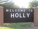
Holly welcome sign.
-
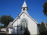
First Christian Church in Holly.
-
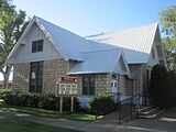
First United Methodist Church in Holly is located across the highway from First Christian Church.


See also
 In Spanish: Holly (Colorado) para niños
