Hooper, Colorado facts for kids
Quick facts for kids
Hooper, Colorado
|
|
|---|---|
| Town of Hooper | |
|
The Demon Sculpture in Hooper
|
|

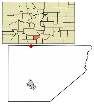
Location of the Town of Hooper in the Alamosa County, Colorado.
|
|
| Country | |
| State | |
| County | Alamosa County |
| Incorporated (town) | May 20, 1898 |
| Government | |
| • Type | Statutory Town |
| Area | |
| • Total | 0.25 sq mi (0.65 km2) |
| • Land | 0.25 sq mi (0.65 km2) |
| • Water | 0.00 sq mi (0.00 km2) |
| Elevation | 7,559 ft (2,304 m) |
| Population
(2020)
|
|
| • Total | 81 |
| • Density | 324/sq mi (124.6/km2) |
| Time zone | UTC-7 (MST) |
| • Summer (DST) | UTC-6 (MDT) |
| ZIP code |
81136
|
| Area code(s) | 719 |
| FIPS code | 08-37380 |
| GNIS feature ID | 2412766 |
The Town of Hooper is a small town located in the San Luis Valley in Alamosa County, Colorado, United States. It is known as a Statutory Town. In 2020, the population of Hooper was 81 people.
Contents
Hooper's Location and Surroundings
Hooper covers a small area of land, about 0.65 square kilometers (0.25 square miles). It is located in a beautiful part of Colorado.
Nearby Places to Explore
There are some interesting places close to Hooper. These include the amazing Great Sand Dunes National Park, where you can see huge sand dunes. The town of Crestone is also nearby.
Hooper's History
The post office in Hooper was first opened on January 26, 1891. At that time, it was called Garrison. However, on July 17, 1896, the name was changed to Hooper. This new name honors Major S. Hooper, who was an important official for the railroad.
County Changes Over Time
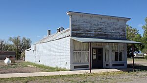
Hooper was originally part of Costilla County, Colorado. But on March 8, 1913, the state government decided to create a new county called Alamosa County. From that day on, Hooper became part of Alamosa County. The old Howard Store building now serves as the town hall.
Population and Demographics
Demographics is the study of a population, looking at things like how many people live in a place and how that number changes over time. The population of Hooper has changed quite a bit throughout its history.
| Historical population | |||
|---|---|---|---|
| Census | Pop. | %± | |
| 1900 | 177 | — | |
| 1910 | 131 | −26.0% | |
| 1920 | 156 | 19.1% | |
| 1930 | 155 | −0.6% | |
| 1940 | 170 | 9.7% | |
| 1950 | 103 | −39.4% | |
| 1960 | 58 | −43.7% | |
| 1970 | 80 | 37.9% | |
| 1980 | 71 | −11.2% | |
| 1990 | 112 | 57.7% | |
| 2000 | 123 | 9.8% | |
| 2010 | 103 | −16.3% | |
| 2020 | 81 | −21.4% | |
In 1900, 177 people lived in Hooper. The population went up and down over the years. By 2020, it was 81 people.
See also
 In Spanish: Hooper (Colorado) para niños


