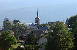
Hotonnes facts for kids
Quick facts for kids
Hotonnes
|
|
|---|---|
|
Part of Haut Valromey
|
|
 |
|
| Country | France |
| Region | Auvergne-Rhône-Alpes |
| Department | Ain |
| Arrondissement | Belley |
| Canton | Plateau d'Hauteville |
| Commune | Haut Valromey |
| Area
1
|
28.7 km2 (11.1 sq mi) |
| Population
(2019)
|
265 |
| • Density | 9.23/km2 (23.91/sq mi) |
| Time zone | UTC+01:00 (CET) |
| • Summer (DST) | UTC+02:00 (CEST) |
| Postal code |
01260
|
| Elevation | 636–1,338 m (2,087–4,390 ft) (avg. 736 m or 2,415 ft) |
| 1 French Land Register data, which excludes lakes, ponds, glaciers > 1 km2 (0.386 sq mi or 247 acres) and river estuaries. | |
Hotonnes was a small commune (which is like a local town or village area) located in the Ain department in eastern France. Think of a commune as a local government area, similar to a township or a small municipality. On January 1, 2016, Hotonnes joined with other nearby communes to form a larger new commune called Haut Valromey. This means Hotonnes no longer exists as a separate commune, but it's still a place within the bigger Haut Valromey area.
Contents
Understanding Communes in France
In France, a commune is the smallest unit of local government. It's like a town or a village, along with its surrounding area. Each commune has its own mayor and local council. They manage things like local services, schools, and roads.
Why Communes Merge
Sometimes, smaller communes decide to merge together. This can happen for several reasons:
- Better services: Merging can help them offer better public services.
- More resources: They might have more money and resources as a larger group.
- Stronger voice: A bigger commune can have a stronger voice in regional decisions.
This is what happened with Hotonnes when it became part of Haut Valromey.
Where Was Hotonnes Located?
Hotonnes was situated in the Ain department, which is in the eastern part of France. This region is known for its beautiful landscapes, including mountains and valleys. The area around Hotonnes is part of the Jura Mountains, offering lovely natural scenery.
Geography of the Area
The former commune of Hotonnes had an elevation that ranged from 636 meters (about 2,087 feet) to 1,338 meters (about 4,390 feet) above sea level. This shows it was in a hilly or mountainous region. The total area of Hotonnes was about 28.7 square kilometers (about 11.1 square miles).
Population Changes Over Time
The number of people living in Hotonnes changed over the years. Here's a quick look at its population before it merged:
| Historical population | ||
|---|---|---|
| Year | Pop. | ±% p.a. |
| 2006 | 299 | — |
| 2011 | 299 | +0.00% |
| 2019 | 265 | −1.50% |
| Source: INSEE | ||
As you can see, the population was around 299 people in 2006 and 2011. By 2019, the population for the area that was Hotonnes was recorded as 265 people. This data helps us understand how small the commune was before it merged.
See also
 In Spanish: Hotonnes para niños
 | Georgia Louise Harris Brown |
 | Julian Abele |
 | Norma Merrick Sklarek |
 | William Sidney Pittman |


