Houstonia, Missouri facts for kids
Quick facts for kids
Houstonia, Missouri
|
|
|---|---|

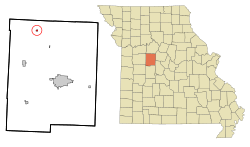
Location of Houstonia, Missouri
|
|
| Country | United States |
| State | Missouri |
| County | Pettis |
| Area | |
| • Total | 0.20 sq mi (0.51 km2) |
| • Land | 0.20 sq mi (0.51 km2) |
| • Water | 0.00 sq mi (0.00 km2) |
| Elevation | 771 ft (235 m) |
| Population
(2020)
|
|
| • Total | 198 |
| • Density | 1,000.00/sq mi (386.59/km2) |
| Time zone | UTC-6 (Central (CST)) |
| • Summer (DST) | UTC-5 (CDT) |
| ZIP code |
65333
|
| Area code(s) | 660 |
| FIPS code | 29-33256 |
| GNIS feature ID | 2394428 |
Houstonia is a small city in Pettis County, Missouri, in the United States. It is located in the northwest part of the county. In 2020, about 198 people lived there.
Contents
A Look at Houstonia's History
Houstonia was officially planned and marked out in 1871. This process is called platting. The community was named after General Thomas F. Houston. He was one of the first people to settle in the area.
A post office opened in Houstonia in 1872. It has been helping people send and receive mail ever since.
Some important places in the area are part of the Osage Farms Resettlement Properties in Pettis County, Missouri. These properties were added to the National Register of Historic Places in 1991. This means they are important historical sites.
Exploring Houstonia's Geography
Houstonia is found where two Missouri roads meet: Route K and Route OO. It is about 2.5 miles south of the line between Pettis and Saline counties. The city is also about 15 miles northwest of Sedalia.
A stream called Buffalo Creek flows along the east side of Houstonia.
The city covers a total area of about 0.20 square miles (0.51 square kilometers). All of this area is land, with no water.
Understanding Houstonia's Population
| Historical population | |||
|---|---|---|---|
| Census | Pop. | %± | |
| 1890 | 278 | — | |
| 1900 | 307 | 10.4% | |
| 1910 | 349 | 13.7% | |
| 1920 | 407 | 16.6% | |
| 1930 | 346 | −15.0% | |
| 1940 | 326 | −5.8% | |
| 1950 | 309 | −5.2% | |
| 1960 | 261 | −15.5% | |
| 1970 | 312 | 19.5% | |
| 1980 | 327 | 4.8% | |
| 1990 | 283 | −13.5% | |
| 2000 | 275 | −2.8% | |
| 2010 | 220 | −20.0% | |
| 2020 | 198 | −10.0% | |
| U.S. Decennial Census | |||
Population Details from 2010
In 2010, the city of Houstonia had 220 people. There were 82 homes, and 57 of these were families. The city had about 1100 people per square mile.
Most people living in Houstonia were White (97.7%). A small number were African American (0.5%), Native American (0.5%), or Asian (0.9%). Some people were from two or more races (0.5%). About 0.5% of the population was Hispanic or Latino.
Many homes (34.1%) had children under 18 living there. More than half (56.1%) were married couples. Some homes had a female head of household (8.5%) or a male head of household (4.9%) without a spouse. About 30.5% of homes were not families.
Almost a quarter (24.4%) of all homes had only one person living there. About 9.8% of these single-person homes were people aged 65 or older. On average, there were 2.68 people in each home and 3.18 people in each family.
The average age of people in Houstonia was 36.5 years old. About 23.2% of residents were under 18. About 11.8% were between 18 and 24. A large group (28.2%) was between 25 and 44. People aged 45 to 64 made up 23.1% of the population. Finally, 13.6% were 65 years or older. The city had slightly more males (51.4%) than females (48.6%).
See also
 In Spanish: Houstonia (Misuri) para niños

