Huinganco facts for kids
Quick facts for kids
Huinganco
|
|
|---|---|
|
Municipality and village
|
|

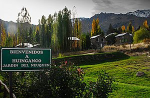
Entrance to Huinganco
|
|
| Nickname(s):
Neuquen's garden
|
|
| Country | |
| Province | Neuquén Province |
| Elevation | 4,357 ft (1,328 m) |
| Time zone | UTC−3 (ART) |
| Area code(s) | 02948 |
| Climate | Csb |
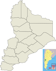
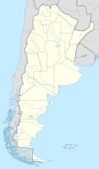
Huinganco is a small village and municipality in southwestern Argentina. It's located in the Neuquén Province, about 470 kilometers northwest of Neuquén city, the province capital. This village sits in the Neuquén River valley, right at the base of the Cordillera del Viento mountain range. People often call it the "garden of the province" because it's so beautiful!
Contents
History of Huinganco
The name Huinganco comes from the Pehuenche language. It combines two words: huingan, which is a type of local plant, and co, meaning water or stream. So, Huinganco means "huingan creek."
The Pehuenche people first settled in this area a very long time ago, between the 8th and 9th centuries. They chose this spot because its wetlands were perfect for raising animals.
In 1879, the first local government for the Neuquén Territory was set up near Huinganco. A few years later, the first settlers arrived. These were mostly ranchers and farmers from Chile.
Gold Mining and Growth
In 1883, people started gold mining in the region. This brought many new people to the area. Gold mining became very popular between the 1920s and 1950s.
However, in the 1960s, gold prices dropped. This made it hard for the town's economy. Many young people left Huinganco to find jobs in Neuquén city.
Founding and Revival
Huinganco officially became a village in 1964. To help the town, local leaders started planting trees on the Cordillera del Viento mountains. They also opened a plant nursery. This nursery became Argentina's first community forest, helping the town's economy grow again.
Geography and Nature
Huinganco is located on the left side of the Neuquén River. It sits at the foot of the Cordillera del Viento, which means "Wind Mountain range."
Several creeks flow through this area. These include Butalón Norte, Huingan Co, and Manzano. The land around the village has many pine forests and dry steppes.
Corona Mountain
The nearby Corona mountain is a special place. It stands about 2,992 meters above sea level. It's considered one of the most important spots in the region. Corona mountain is also the highest peak in the Cordillera del Viento.
Economy and Tourism
The main part of Huinganco's economy is afforestation, which means planting and growing forests. The town's plant nursery opened in 1968. Other businesses, like a marmalade factory and fish farming, are also important.
Huinganco: The Garden of Neuquén
Huinganco is known as Neuquén's garden. This is because of its beautiful forests, gardens, and surrounding nature. Because of this beauty, tourism has become a big part of the town's income.
It's a popular place for outdoor activities. Visitors enjoy trekking, hiking, and horse riding. They can explore amazing places in the Cordillera del Viento. These include the Huinganco lagoon and the Corona mountain.
Population Growth
Huinganco has seen its population grow over the years.
- In 1970, there were 285 people.
- By 1980, the population grew to 428.
- In 1991, it reached 743 people.
- The population increased from 910 in 2001 to 1,010 in 2010.
See also
 In Spanish: Huinganco para niños
 | John T. Biggers |
 | Thomas Blackshear |
 | Mark Bradford |
 | Beverly Buchanan |


