
Hurtsboro, Alabama facts for kids
Quick facts for kids
Hurtsboro, Alabama
|
|
|---|---|
|
Town
|
|
 |
|

Location of Hurtsboro in Russell County, Alabama.
|
|
| Country | United States |
| State | Alabama |
| County | Russell |
| Area | |
| • Total | 1.03 sq mi (2.67 km2) |
| • Land | 1.03 sq mi (2.67 km2) |
| • Water | 0.00 sq mi (0.00 km2) |
| Elevation | 351 ft (107 m) |
| Population
(2020)
|
|
| • Total | 349 |
| • Density | 337.85/sq mi (130.49/km2) |
| Time zone | UTC-6 (Central (CST)) |
| • Summer (DST) | UTC-5 (CDT) |
| ZIP code |
36860
|
| Area code(s) | 334 |
| FIPS code | 01-37096 |
| GNIS feature ID | 0151840 |
Hurtsboro is a town located in Russell County, Alabama, in the United States. In 2020, about 349 people lived there. The town was founded in 1857. It was first called Hurtsville. The name came from Joel Hurt, Sr. His son, Joel Hurt, later became an important builder in Atlanta, Georgia.
A railroad line from Columbus, Georgia reached Hurtsboro in 1858. The town officially became a city in 1872. In 1883, its name was changed to Hurtsboro. The town is part of the larger Columbus, Georgia-Alabama area.
History
In 1920, a challenging historical event took place in Hurtsboro. It involved a standoff at a house. Newspapers at the time described it as a "New Race War."
Geography
Hurtsboro is located at coordinates 32.240102 degrees North and 85.415377 degrees West. This means it is in the southeastern part of Alabama.
The U.S. Census Bureau says the town covers about 1.0 square mile (2.6 square kilometers). All of this area is land.
Population and People
The number of people living in Hurtsboro has changed over the years. Here is a look at the population from different census counts:
| Historical population | |||
|---|---|---|---|
| Census | Pop. | %± | |
| 1890 | 433 | — | |
| 1900 | 407 | −6.0% | |
| 1910 | 764 | 87.7% | |
| 1920 | 868 | 13.6% | |
| 1930 | 884 | 1.8% | |
| 1940 | 894 | 1.1% | |
| 1950 | 920 | 2.9% | |
| 1960 | 1,056 | 14.8% | |
| 1970 | 937 | −11.3% | |
| 1980 | 752 | −19.7% | |
| 1990 | 707 | −6.0% | |
| 2000 | 592 | −16.3% | |
| 2010 | 553 | −6.6% | |
| 2020 | 349 | −36.9% | |
| U.S. Decennial Census 2013 Estimate |
|||
2020 Census Information
The 2020 United States census counted 349 people living in Hurtsboro. There were 221 households and 151 families.
Here is a breakdown of the different groups of people living in Hurtsboro in 2020:
| Race | Number of People | Percentage |
|---|---|---|
| White (not Hispanic) | 138 | 39.54% |
| Black or African American (not Hispanic) | 188 | 53.87% |
| Pacific Islander | 1 | 0.29% |
| Other/Mixed | 14 | 4.01% |
| Hispanic or Latino | 8 | 2.29% |
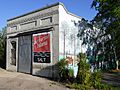
Gallery
-
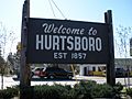
Town welcome sign
-
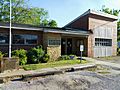
Hurtsboro City Hall
-
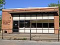
Hurtsboro Post Office (ZIP code: 36860)
-
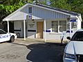
Hurtsboro Police Department
-
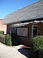
Hurtsboro Library
-
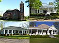
The Hurtsboro Historic District was added to the National Register of Historic Places on October 19, 2009.
-
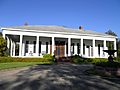
The Joel Hurt House was built in 1857. It was added to the National Register of Historic Places on August 11, 2005.
-
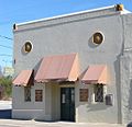
The City Grill Café is a local landmark.
-
Pat H. Perry Hardware
-
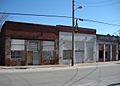
Some of the older buildings on Main Street.


See also

- In Spanish: Hurtsboro para niños
