Hyrum, Utah facts for kids
Quick facts for kids
Hyrum, Utah
|
|
|---|---|

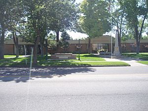
Hyrum Civic Center
|
|

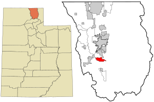
Location in Cache County and the state of Utah
|
|
| Country | United States |
| State | Utah |
| County | Cache |
| Named for | Hyrum Smith |
| Area | |
| • Total | 6.19 sq mi (16.03 km2) |
| • Land | 6.18 sq mi (16.00 km2) |
| • Water | 0.01 sq mi (0.03 km2) |
| Elevation | 4,780 ft (1,432 m) |
| Population
(2020)
|
|
| • Total | 9,362 |
| • Density | 1,395.11/sq mi (538.66/km2) |
| Time zone | UTC-7 (Mountain (MST)) |
| • Summer (DST) | UTC-6 (MDT) |
| ZIP code |
84319
|
| Area code(s) | 435 |
| FIPS code | 49-37500 |
| GNIS feature ID | 2410088 |
Hyrum is a city located in Cache County, Utah. In 2020, about 9,362 people lived there. It's part of the bigger Logan area. Hyrum is special because it's home to fun places like Hyrum State Park, Hardware Ranch, and Porcupine Reservoir.
Contents
A Look Back: Hyrum's History
Hyrum was started in 1860 by 23 families. Many of these families were immigrants from Denmark or were related to a man named Ezra T. Benson. A church group, called a "ward," was formed in Hyrum in May 1860. The town got its own post office in 1861.
By 1900, Hyrum had grown quite a bit, and its church ward was split into three parts. In 1930, the city had 1,869 people living there.
Where is Hyrum?
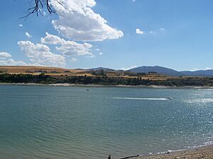
Hyrum is found near the southern end of the Cache Valley. It's next to Hyrum Reservoir on its southwest side.
The city covers a total area of about 12.5 square kilometers (about 4.8 square miles). Only a tiny part of this area, about 0.26%, is water.
Hyrum's Weather
Hyrum has a type of weather called a "humid continental climate." This means it has big changes in temperature throughout the year. Summers are warm to hot, and sometimes humid. Winters are cold, and can sometimes be very cold.
Who Lives in Hyrum?
| Historical population | |||
|---|---|---|---|
| Census | Pop. | %± | |
| 1870 | 708 | — | |
| 1880 | 1,234 | 74.3% | |
| 1890 | 1,423 | 15.3% | |
| 1900 | 1,652 | 16.1% | |
| 1910 | 1,833 | 11.0% | |
| 1920 | 1,858 | 1.4% | |
| 1930 | 1,869 | 0.6% | |
| 1940 | 1,874 | 0.3% | |
| 1950 | 1,704 | −9.1% | |
| 1960 | 1,728 | 1.4% | |
| 1970 | 2,340 | 35.4% | |
| 1980 | 3,952 | 68.9% | |
| 1990 | 4,829 | 22.2% | |
| 2000 | 6,316 | 30.8% | |
| 2010 | 7,609 | 20.5% | |
| 2020 | 9,362 | 23.0% | |
| U.S. Decennial Census | |||
In 2000, there were 6,316 people living in Hyrum. By 2010, the population grew to 7,609. In 2020, it reached 9,362 people.
Many families live in Hyrum. In 2000, almost 60% of households had children under 18 living with them. The average household had about 3.75 people.
The city's population is quite young. About 40% of the people were under 18 years old. The average age was 24 years.
Fun Places to Visit
Hyrum has some great spots for outdoor fun and learning!
Hyrum State Park
Hyrum State Park is a popular place right on Hyrum Reservoir. It's perfect for many activities like fishing, water skiing, swimming, and camping.
The park has lots of trees, making it a nice spot for a picnic. You can also spend a weekend on the lake trying to catch different kinds of fish, like yellow perch, rainbow trout, bluegill, and largemouth bass. You can even see live camera views of Hyrum State Park online!
Hardware Ranch
If you travel east from Hyrum up Blacksmith Fork Canyon, you'll find Hardware Ranch. This is a special wildlife area where large groups of elk spend the winter. You can even take sleigh rides that go right into the elk herd, which is a really cool experience!
Famous People from Hyrum
Some notable people have come from Hyrum, including:
- Hadley Cantril, a well-known psychologist.
- Jake Kuresa, a player in the NFL (National Football League).
- Dean L. Larsen, a leader in the Church of Jesus Christ of Latter-day Saints.
- Chase Nielsen, an officer in the United States Air Force and a prisoner of war.
- Ingvald Conrad Thoresen, who served in the Utah House of Representatives.
- Hans Wight, a politician who served in the Legislative Assembly of Alberta in Canada.
- Keith W. Wilcox, another leader in the Church of Jesus Christ of Latter-day Saints.
See also
 In Spanish: Hyrum (Utah) para niños
 | Sharif Bey |
 | Hale Woodruff |
 | Richmond Barthé |
 | Purvis Young |


