Iguala facts for kids
Quick facts for kids
Iguala
|
|
|---|---|
| Iguala de la Independencia | |

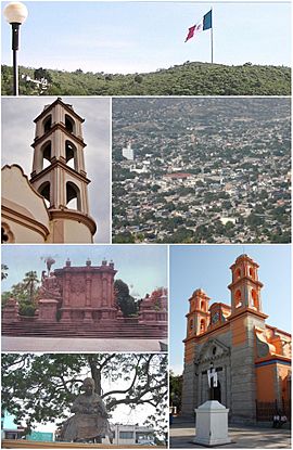
Above, from left to right: Side, Dome, and part of the Parish of San Francisco de Asís, The monumental flag, Parish of San Juan Bautista, Statue of Francisco de Asís in front of the parish and Panoramic from the flagstick in the Hill the Tehuehue.
|
|
| Country | Mexico |
| State | Guerrero |
| Municipality | Iguala de la Independencia |
| Population
(2005)
|
|
| • Total | 110,390 |
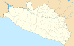
Iguala, officially known as Iguala de la Independencia, is a historic city in Mexico. It is located in the state of Guerrero, in the southwestern part of the country. The city is about 102 kilometers (63 miles) from Chilpancingo, which is the state capital.
Contents
Exploring Iguala's Location
Iguala is found in the north-central part of the state of Guerrero. It is situated along Federal Highway 95. This makes it an important connection point. The city is about 130 kilometers (81 miles) southwest of Mexico City.
Iguala is the main town of the Municipality of Iguala de la Independencia. In 2005, the city had a population of 110,390 people. The entire municipality had 128,444 residents. Iguala is the third-largest community in Guerrero. Only Acapulco and Chilpancingo are larger. The municipality covers an area of about 567.1 square kilometers (219 square miles).
Iguala's Role in Mexican Independence
Iguala holds a very special place in Mexican history. It is often called the "birthplace of the Mexican Flag." This is because of a key event that happened here.
The Plan de Iguala
On February 24, 1821, the Plan de Iguala was signed. This important agreement was made by Agustín de Iturbide and Vicente Guerrero. It marked the end of the long Mexican War of Independence against Spain.
The First Mexican Flag
After the Plan de Iguala was signed, the first national flag was created. It was known as the Flag of the Three Guarantees. This flag represented Mexico's new independence. José Magdaleno Ocampo made this historic flag. General Vicente Guerrero was the first military leader to promise loyalty to this new flag. He did this in Acatempan on March 12, 1821.
Discovering Iguala's Landmarks
Iguala has several interesting places to visit. These include a beautiful church and a peaceful lagoon.
The San Francisco Church
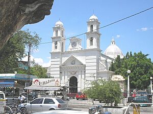
The San Francisco Church (Iglesia de San Francisco) is a famous landmark in the city. It was built in the 19th century. The church features a Neoclassical style. Many tamarind trees surround the church. Because of these trees, Iguala is known as "la Ciudad Tamarindera," which means "the Tamarindo city."
The Lagoon of Tuxpan
Just outside the city, you can find the Lagoon of Tuxpan (Laguna de Tuxpan). This lake is located in the small town of Tuxpan. It is known for its natural beauty. Many popular seafood restaurants are also found here. The people of Tuxpan work hard to keep the lagoon healthy. Locals and city visitors enjoy it every weekend.
Annual Celebrations in Iguala
One of the most important events in Iguala is the Iguala Flag Fair. This fair is held every year in late February. It celebrates the city's historical importance.
The Iguala Flag Fair
The Iguala Flag Fair is a big annual festivity for the people of Iguala. The celebration includes a parade with colorful floats. There are also traditional cockfights. Visitors can enjoy exhibitions of Mexican handcrafts and folk art. Local artisans in Iguala are famous for creating beautiful gold and silver jewelry.
Sister City
 United States Aurora (2007)
See also
 In Spanish: Iguala de la Independencia para niños
 | John T. Biggers |
 | Thomas Blackshear |
 | Mark Bradford |
 | Beverly Buchanan |


