
Ilchester, Maryland facts for kids
Quick facts for kids
Ilchester, Maryland
|
|
|---|---|

Beechwood Road and Bonnie Branch Road in Ilchester
|
|

Ilchester, Maryland
Location in Maryland

Ilchester, Maryland
Location in the United States
|
|
| Country | |
| State | |
| County | Howard |
| Settled | 1761 |
| Named for | Ilchester |
| Area | |
| • Total | 10.82 sq mi (28.02 km2) |
| • Land | 10.76 sq mi (27.86 km2) |
| • Water | 0.06 sq mi (0.16 km2) |
| Elevation | 100 ft (30 m) |
| Population
(2020)
|
|
| • Total | 26,824 |
| • Density | 2,494.10/sq mi (962.96/km2) |
| Time zone | UTC−5 (Eastern (EST)) |
| • Summer (DST) | UTC−4 (EDT) |
| FIPS code | 24-41475 |
| GNIS feature ID | 588678 |
Ilchester is a community in Howard County, Maryland, in the United States. It is also called a census-designated place, which means it's an area defined for counting people in the census. In 2010, about 23,476 people lived there. The community got its name from a village called Ilchester in England.
Contents
History of Ilchester

Rock formations called Pegmatite dikes near the river in Ilchester around 1895
|
Early Settlements and Mills
In 1761, a man named John Cornthwaite built a wood mill. It was called the Dismal Mill. This mill was located near the Patapsco River, not far from Ellicott City.
Later, in the late 1700s, the Ellicott family moved to the area. They bought a large piece of land along the Patapsco River. This land included Ilchester and another area called Ellicott Mills.
Railroad and Development
The Baltimore and Ohio Railroad (B&O) built train tracks through Ilchester in 1830. This railroad followed the Patapsco River valley. George Ellicott, Jr., who was a grandson of one of the first Ellicotts, built a tavern and a shop for making barrels next to the railroad.
In 1837, a company called Thistle Manufacturing Company built a factory. However, Ilchester did not become a very important stop for the B&O railroad. This was because the train tracks had steep hills there. The tavern also did not do very well. In 1842, mail service started, and the train station was named "Illchester Mills".
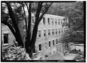
St. Mary's College
In 1866, the Ellicott family sold their tavern and a large piece of land to a church group called the Redemptorist order. This church group used the land to start a college. It opened in 1868 and was first called Mount Saint Clemens.
Over time, more buildings were added to the college, including a chapel. In 1882, the college's name changed to Saint Mary's College. The chapel became a church in 1893, dedicated to "Our Lady of Perpetual Help". The church later moved to a new building in 1958. The number of students at the college went down, and it closed in 1972. In 1987, the State of Maryland bought part of the college campus. This land was added to the nearby Patapsco Valley State Park.
Girl Scout Camp
In 1949, the Girl Scouts in Baltimore bought a place called "Camp Ilchester". This camp is still used by Girl Scouts today.
Geography of Ilchester

Ilchester is located at 39°15′03″N 76°45′53″W / 39.25083°N 76.76472°W. It is in Howard County. To the northwest is Ellicott City, and to the southeast is Elkridge. Columbia is to the southwest.
The Patapsco River forms the edge of the community on the northeast side. This river is also the border between Howard County and Baltimore County. Across the river is the community of Catonsville.
The original part of Ilchester, where the mill was, is along the Patapsco River. This is where Ilchester Road and Bonnie Branch Roads meet. However, the area known as Ilchester today is much larger. It includes many suburban areas in Howard County.
Roads and Transportation
Maryland Route 103, also known as Montgomery Road, is a main road through Ilchester. Maryland Route 100 is a highway that goes through the southern part of Ilchester. You can get off Route 100 at Exit 4 to reach Montgomery Road. Further south, Route 100 connects with Interstate 95. Interstate 95 forms the southeastern border of the Ilchester area.
Area and Water
According to the United States Census Bureau, the total area of Ilchester is about 28.0 square kilometers (10.8 square miles). Most of this area, about 27.8 square kilometers (10.76 square miles), is land. A small part, about 0.2 square kilometers (0.06 square miles), is water.
Population of Ilchester
| Historical population | |||
|---|---|---|---|
| Census | Pop. | %± | |
| 2020 | 26,824 | — | |
| U.S. Decennial Census | |||
In 2020, the population of Ilchester was 26,824 people. This means that many people live in this community. The population density is about 962.96 people per square kilometer (2494.10 people per square mile).
See also
 In Spanish: Ilchester (Maryland) para niños
