
Image: Bering Strait
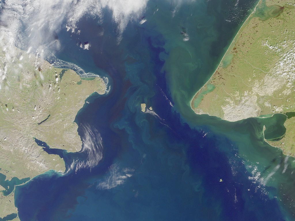
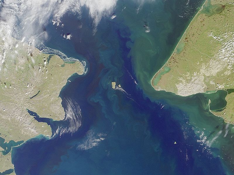
Description: Bering strait, image taken by MISR satellite. With the Seward Peninsula of Alaska to the east, and Chukotskiy Poluostrovof Siberia to the west, the Bering Strait separates the United States and the Russian Federation by only 90 kilometers. It is named for Danish explorer Vitus Bering, who spotted the Alaskan mainland in 1741 while leading an expedition of Russian sailors. This view of the region was captured by MISR's vertical-viewing (nadir) camera on August 18, 2000 during Terra orbit 3562. The boundary between the US and Russia lies between Big and Little Diomede Islands, which are visible in the middle of the Bering Strait. The Arctic Circle, at 66.5 degrees north latitude, runs through the Arctic Ocean in the top part of this image. This circle marks the southernmost latitude for which the Sun does not rise above the horizon on the day of the winter solstice. At the bottom of this image is St. Lawrence Island. Situated in the Bering Sea, it is part of Alaska and home to Yupik Eskimos. MISR was built and is managed by NASA's Jet Propulsion Laboratory, Pasadena, CA, for NASA's Office of Earth Science, Washington, DC. The Terra satellite is managed by NASA's Goddard Space Flight Center, Greenbelt, MD. JPL is a division of the California Institute of Technology. For more information: http://www-misr.jpl.nasa.gov
Title: Bering Strait
Credit: http://photojournal.jpl.nasa.gov/catalog/PIA02638
Author: NASA/GSFC/JPL/MISR-Team
Permission: This file is in the public domain in the United States because it was solely created by NASA. NASA copyright policy states that "NASA material is not protected by copyright unless noted". (See Template:PD-USGov, NASA copyright policy page or JPL Image Use Policy.) Warnings: Use of NASA logos, insignia and emblems is restricted per U.S. law 14 CFR 1221. The NASA website hosts a large number of images from the Soviet/Russian space agency, and other non-American space agencies. These are not necessarily in the public domain. Materials based on Hubble Space Telescope data may be copyrighted if they are not explicitly produced by the STScI.[1] See also Template:PD-Hubble and Template:Cc-Hubble. The SOHO (ESA & NASA) joint project implies that all materials created by its probe are copyrighted and require permission for commercial non-educational use. [2] Images featured on the Astronomy Picture of the Day (APOD) web site may be copyrighted. [3] The National Space Science Data Center (NSSDC) site has been known to host copyrighted content even though its photo gallery FAQ states that all of the images in the photo gallery are in the public domain.
Usage Terms: Public domain
License: Public domain
Attribution Required?: No
Image usage
The following 9 pages link to this image:
