
Image: U.S. Territorial Acquisitions
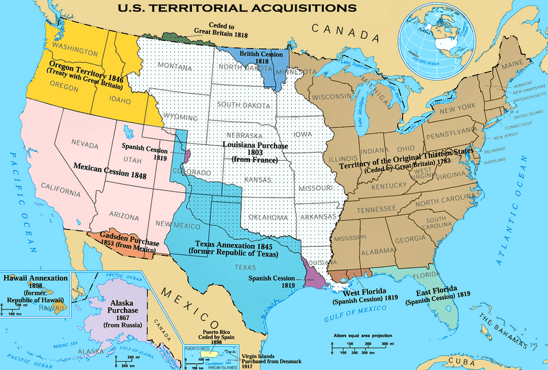
Description: The Territorial acquisitions of the United States, such as the Thirteen Colonies, the Louisiana Purchase, British and Spanish Cession, and so on.
Title: U.S. Territorial Acquisitions
Credit: National Atlas of the United States [1]
Author: United States federal government (en:User:Black and White converted it from JPEG to PNG and retouched it)
Permission: This map was obtained from an edition of the National Atlas of the United States. Like almost all works of the U.S. federal government, works from the National Atlas are in the public domain in the United States. Online access: NationalAtlas.gov | 1970 print edition: Library of Congress, Perry-Castañeda Library čeština | Deutsch | English | français | Bahasa Indonesia | italiano | македонски | മലയാളം | 中文 | 中文(简体) | 中文(繁體) | +/−
Usage Terms: Public domain
License: Public domain
Attribution Required?: No
Image usage
The following 17 pages link to this image:
- Adams–Onís Treaty
- American imperialism
- Eastern United States
- Expansionism
- Gadsden Purchase
- Geography of the United States
- Historical regions of the United States
- History of Western civilization
- History of the United States
- Indian Territory
- Oregon Trail
- Territorial era of Minnesota
- Treaty of 1818
- Treaty of Aranjuez (1779)
- U.S. territorial sovereignty
- U.S. territory
- United States
