
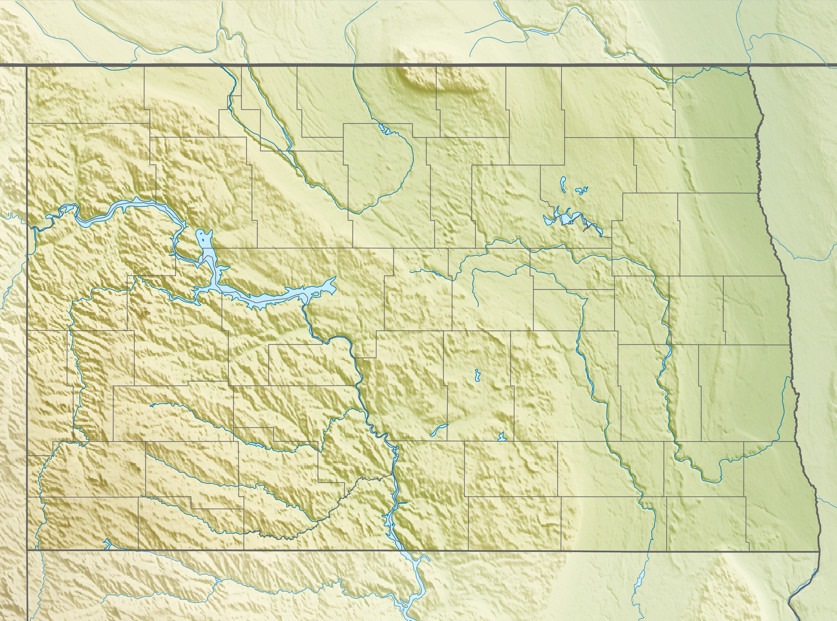
Image: USA North Dakota relief location map
Description: Physical location map of North Dakota, USA
Title: USA North Dakota relief location map
Credit: Own work, using File:USA North Dakota location map.svg by Alexrk2. STRM-30 data for the relief
Author: Carport
Permission: This file is licensed under the Creative Commons Attribution-Share Alike 3.0 Unported license. You are free: to share – to copy, distribute and transmit the work to remix – to adapt the work Under the following conditions: attribution – You must give appropriate credit, provide a link to the license, and indicate if changes were made. You may do so in any reasonable manner, but not in any way that suggests the licensor endorses you or your use. share alike – If you remix, transform, or build upon the material, you must distribute your contributions under the same or compatible license as the original. https://creativecommons.org/licenses/by-sa/3.0 CC BY-SA 3.0 Creative Commons Attribution-Share Alike 3.0 truetrue
Usage Terms: Creative Commons Attribution-Share Alike 3.0
License: CC BY-SA 3.0
License Link: https://creativecommons.org/licenses/by-sa/3.0
Attribution Required?: Yes
Image usage
The following 30 pages link to this image:
- Baldhill Dam
- Boundary Lake
- Bowman-Haley Dam
- Court Lake
- Devils Lake (North Dakota)
- Fargo, North Dakota
- Garrison Dam
- Glacial Lake McKenzie
- Heart Butte Dam
- Homme Lake
- Jamestown Dam
- Lake Addie (North Dakota)
- Lake Darling Dam
- Lake Elsie
- Lake Ibsen
- Lake Jessie (North Dakota)
- Lake Metigoshe
- Lake Sakakawea
- Lake Souris
- Lake Upsilon
- Little Missouri River (North Dakota)
- Pipestem Dam
- Red Willow Lake (Griggs County, North Dakota)
- Renwick Dam
- Rice Lake (Ward County, North Dakota)
- Sibley Lake (Kidder County, North Dakota)
- Stump Lake (North Dakota)
- The Standing Rock Rural Water System
- Van Hook, North Dakota
- White Butte
