Glacial Lake McKenzie facts for kids
Quick facts for kids Lake McKenzie |
|
|---|---|
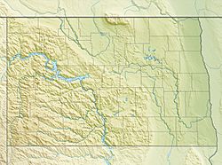
| Location | McLean, Mercer, and Dunn, Counties, North Dakota |
| Coordinates | 47°31′43″N 101°24′22″W / 47.528614°N 101.406182°W |
| Lake type | Glacial lake (former) |
| Primary inflows | Laurentide Ice Sheet |
| Primary outflows | Over the divide to the Yellowstone River or along the face of the Ice sheet. |
| Basin countries | United States |
| Max. length | about 140 miles (230 km) |
| Max. width | 40 miles (64 km) |
| Surface area | varied |
| Surface elevation | 1,940 m (6,360 ft) |
Lake McKenzie was a massive ancient lake that existed in what is now North Dakota. It formed a very long time ago, about two million years before today, during a period called the Pleistocene Ice Age. This huge lake was created by a giant sheet of ice that blocked the flow of rivers. It played a big part in shaping the landscape of North Dakota and nearby areas.
Contents
How Lake McKenzie Formed
Before the Ice Age, rivers in North Dakota, South Dakota, and eastern Montana flowed north. They eventually emptied into Hudson Bay in Canada. But then, a massive ice sheet started to grow.
The Giant Ice Blocker
A huge part of the Laurentide Ice Sheet, called the Keewatin Lobe, moved south. This giant wall of ice blocked the rivers that flowed north. When the rivers couldn't flow, their water started to pile up. This created large lakes right in front of the ice sheet.
Finding New Paths
At first, the trapped river water tried to find new ways to drain. It flowed eastward along the edge of the glacier. This water went into a valley that passed near modern-day Garrison and Riverdale. This old river path is known as the preglacial McClean River.
The Birth of Lake McKenzie
Eventually, the glacier kept moving and blocked this valley too. When that happened, the water had nowhere else to go. It continued to build up, forming the giant body of water we now call Lake McKenzie.
The Lake's Overflow and the Missouri River
As Lake McKenzie grew bigger, its water level rose higher and higher. Eventually, the water became so deep that it spilled over a ridge to the south. This overflow happened near Riverdale, where the modern Garrison Dam is located today.
Cutting a New Path
When the lake's water flowed over this ridge, it started to carve out a new path. This created a "diversion trench" or a new valley for the water to follow. This powerful overflow changed the landscape forever.
The Missouri River's Connection
The path that Lake McKenzie's overflowing water created is now followed by the Missouri River. So, in a way, this ancient glacial lake helped to create part of the modern Missouri River's course. Lake McKenzie itself no longer exists, but its impact on the land is still visible today.


