Imperial River (Chile) facts for kids
Quick facts for kids Imperial River |
|
|---|---|

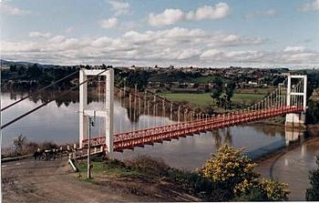
Carahue Suspension Bridge
|
|

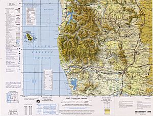
Map of the Region of Temuco
|
|
| Country | Chile |
| Physical characteristics | |
| River mouth | Pacific Ocean |
| Length | 55 km (34 mi) |
| Basin features | |
| Basin size | 12.763 km2 (4.928 sq mi) |
The Imperial River is an important river located in the La Araucanía Region of Chile. It's a natural waterway that plays a big role in the area.
Contents
Where the Imperial River Flows
The Imperial River begins when two other rivers, the Chol Chol and the Cautín, meet. This meeting point is close to the city of Nueva Imperial.
Journey to the Ocean
As the Imperial River flows, it passes by several towns. Two important towns located along its banks are Carahue and Puerto Saavedra. The river eventually reaches the Pacific Ocean.
Nearby Natural Features
Close to where the Imperial River meets the ocean, you can find the outlet of Budi Lake. This means water from Budi Lake flows into the Imperial River. The river also runs along the edge of the Cordillera de Nahuelbuta, which is a mountain range.
Key Facts About the Imperial River
- Length: The Imperial River is about 55 kilometers (34 miles) long.
- Water Flow: On average, about 240 cubic meters of water flow through the river every second. That's a lot of water!
- Basin Size: The area of land that collects water for the Imperial River, called its basin, covers about 12,763 square kilometers (4,928 square miles).
- Location: The river is entirely within Chile, specifically in the La Araucanía Region.
See also
 In Spanish: Río Imperial para niños
 | Stephanie Wilson |
 | Charles Bolden |
 | Ronald McNair |
 | Frederick D. Gregory |

