Cordillera de Nahuelbuta facts for kids
Quick facts for kids Cordillera de Nahuelbuta |
|
|---|---|

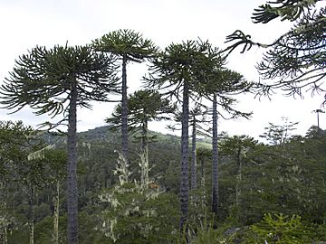
Araucaria araucana forest
|
|
| Highest point | |
| Peak | Alto Nahuelbuta |
| Elevation | 1,565 m (5,135 ft) |
| Geography | |
| Country | Chile |
| State/Province | Bío Bío Region, La Araucanía Region |
| Range coordinates | 37°43′S 73°02′W / 37.717°S 73.033°W |
| Parent range | Cordillera de la costa |
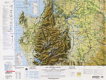
The Nahuelbuta Range, also known as Cordillera de Nahuelbuta, is a mountain range in southern Chile. It stretches along the Pacific Ocean coast. This range is part of the larger Chilean Coast Range.
The name "Nahuelbuta" comes from the Mapudungun language. It combines the words nahuel (meaning jaguar) and futa (meaning big). So, it means "Big Jaguar".
Contents
Forests and Plantations
Much of the Nahuelbuta Range is covered by large plantations of pine and eucalyptus trees. These are often grown as a single type of tree, which is called a monoculture.
How Plantations Started
Some of these plantations were planted in areas where the soil was eroding badly. Other areas were once native forests. These native forests were cleared, often by fire, to make space for the new plantations. Most of these plantations were created in the 1970s, 1980s, and 1990s.
Special Araucaria Trees
At a place called Villa las Araucarias in the Nahuelbuta Range, you can find a small group of special trees. These are some of the southernmost Araucaria araucana trees in the Chilean Coast Range.
In 1950, there were about 1,000 hectares of Araucaria araucana forest here. But by 2016, only 40 hectares remained. This shows how important it is to protect these unique trees.
History of the Range
The Nahuelbuta Range and its nearby valleys were very important during the Arauco War. This was a long conflict between the Mapuche people and the Spanish.
Gold and Settlements
The Spanish wanted to find and collect gold from the rivers around the range. They also wanted the Mapuche people, who lived in the valleys, to work for them. To do this, the Spanish built many settlements and strong, fortified houses around the Nahuelbuta Range.
See also
 In Spanish: Cordillera de Nahuelbuta para niños
- Arauco Basin
- Coastal Batholith of central Chile
- Nahuelbuta National Park
- Forestry in Chile
 | William Lucy |
 | Charles Hayes |
 | Cleveland Robinson |


