
Indiana Dunes National Park facts for kids
Quick facts for kids Indiana Dunes National Park |
|
|---|---|
|
IUCN Category II (National Park)
|
|
| Location | Porter, Lake, and LaPorte Counties, Indiana, United States |
| Nearest city | Beverly Shores, Indiana, Porter, Indiana |
| Area | 15,349 acres (62.12 km2) |
| Established | November 5, 1966 (national lakeshore) February 15, 2019 (national park) |
| Visitors | 2,834,180 (in 2022) |
| Governing body | National Park Service |
Indiana Dunes National Park is an American national park located in northwestern Indiana. It runs for about 15 miles (24 km) along the southern coast of Lake Michigan. The park covers over 15,349 acres (6,212 ha) of land. It includes sandy beaches, towering sand dunes, deep wetlands, open prairies, and shady oak forests.
Congress first protected the area in 1966 as the Indiana Dunes National Lakeshore. On February 15, 2019, the United States Congress changed its name to make it the nation's 61st national park. The park sits between the towns of Gary on the west and Michigan City on the east. Indiana Dunes State Park is another protected reserve nestled right inside the national park borders.
Indiana Dunes National Park is famous for its biological diversity. It ranks among the top national parks in the country for plant variety. Visitors from all over the world travel to the park to hike trails, watch migrating birds, swim at the beaches, and explore rare habitats.
Contents
- History of the Indiana Dunes
- Geography, Rivers, and Waterways
- Weather and Lake Michigan Climate
- How the Dunes Were Formed: Geology
- Plant and Animal Life in the Park
- Famous Natural Landmarks and Habitats
- Historic Landmarks inside the Park
- Outdoor Recreation and Activities
- Educational Programs for Kids and Schools
- Images for kids
- Related Pages
History of the Indiana Dunes


People have lived around and traveled through the Indiana Dunes for thousands of years. The changing shoreline provided food, fresh water, and good transportation routes for both Native Americans and early pioneers.
Early Native American Campgrounds
Long ago, prehistoric people visited the southern shore of Lake Michigan to hunt animals and gather seasonal foods. The Hopewell culture lived in the larger river valleys between 200 BCE and 800 CE. Archaeologists have discovered five groups of ancient earth mounds in the dunes area left behind by ancient cultures.
Later Native American groups, such as the Potawatomi and Miami, set up seasonal villages and camps nearby. They used the rivers and waterways to travel by canoe. The dunes region became a busy crossroads where different groups traded goods and gathered wild berries, nuts, and medicinal plants.
Pioneer Settlements and Trading Posts
In the early 1800s, European-American settlers arrived in the area. A French-Canadian fur trader named Joseph Bailly set up a trading post along the Calumet River in 1822. Bailly traded tools, cloth, and metal items with local Native Americans in exchange for animal furs.
Soon, other pioneers arrived and founded farming communities. Several towns grew nearby, such as Chesterton and Porter. Other settlements, such as a planned city named City West, were built in 1837 but quickly abandoned during a financial crisis. Today, most evidence of these early pioneer boomtowns has vanished beneath the blowing sands and lush forests.
Saving the Dunes for Future Generations
.jpg)
By the late 19th century, scientists realized the Indiana Dunes were special. In 1899, a botanist named Henry Chandler Cowles published important studies on the local plant life. Cowles showed how plant communities changed over time as sand dunes developed, a concept called ecological succession.
At the same time, factories and cities began expanding along Lake Michigan. Sand was mined from the beaches for industrial use. One enormous dune, called the Hoosier Slide, was entirely hauled away in train cars to make glass canning jars.
Conservationists worked tirelessly to protect the remaining wilderness. In 1916, Stephen Mather, the first director of the National Park Service, proposed creating a national park here. While that effort was paused during World War I, the State of Indiana created Indiana Dunes State Park in 1926.
In the 1950s, local citizens formed the Save the Dunes Council, led by activist Dorothy Richardson Buell. Working with United States Senator Paul H. Douglas, they convinced Congress to pass the bill that created the Indiana Dunes National Lakeshore in 1966. On February 15, 2019, Congress officially changed its title to Indiana Dunes National Park.
Geography, Rivers, and Waterways
The national park sits along the southern shore of Lake Michigan. In addition to sandy beaches and towering dunes, the park contains four important natural streams:
- Dunes Creek: A 4.3 miles (6.9 km)* stream that drains water from inland wetlands such as the Great Marsh and Cowles Bog. It flows northward between the dunes and empties directly into Lake Michigan.
- East Arm Little Calumet River: A 22.1 miles (35.6 km)* river section that winds through forested floodplains across LaPorte and Porter Counties before connecting to Burns Waterway.
- Salt Creek: A 24.0 miles (38.6 km)* tributary that flows north from the city of Valparaiso and merges into the Little Calumet River.
- Trail Creek: A 7.3 miles (11.7 km)* creek in LaPorte County that empties into the harbor at Michigan City.
Weather and Lake Michigan Climate

Indiana Dunes National Park experiences a humid continental climate with four distinct seasons. Lake Michigan plays a huge role in the local weather by keeping summers cooler and winters slightly milder near the shoreline.
Winter Shelf Ice Safety
During freezing winter months, strong winds push lake water and slush onto the beaches. This freezes into thick ridges called shelf ice. The frozen shoreline looks like an Arctic landscape with snow-covered mounds.
However, walking on shelf ice is extremely dangerous. The ice is hollow underneath and floats on open water. A person can easily fall through hidden air pockets into the freezing lake below, making rescue very difficult. Park rangers require visitors to view winter ice only from the safety of the dry beach.
Summer Currents and Water Safety
During warm summer days, Lake Michigan is a popular place to swim. Strong north winds, however, can push large waves toward the shore and form fast underwater rivers called rip currents.
Rip currents happen when trapped water behind a shallow sandbar rushes quickly back out to deep water. If swimmers are caught in a rip current, they should not fight the current directly. Instead, they must remain calm and swim parallel to the shore until they escape the pulling water.
| Climate data for Indiana Dunes National Lakeshore (1991–2020 normals) | |||||||||||||
|---|---|---|---|---|---|---|---|---|---|---|---|---|---|
| Month | Jan | Feb | Mar | Apr | May | Jun | Jul | Aug | Sep | Oct | Nov | Dec | Year |
| Mean daily maximum °F (°C) | 32.1 (0.1) |
35.5 (1.9) |
45.6 (7.6) |
57.2 (14.0) |
68.4 (20.2) |
77.5 (25.3) |
81.6 (27.6) |
80.0 (26.7) |
74.3 (23.5) |
62.3 (16.8) |
48.7 (9.3) |
37.4 (3.0) |
58.4 (14.7) |
| Mean daily minimum °F (°C) | 17.8 (−7.9) |
21.1 (−6.1) |
29.8 (−1.2) |
39.5 (4.2) |
49.6 (9.8) |
59.5 (15.3) |
64.3 (17.9) |
63.1 (17.3) |
56.3 (13.5) |
44.7 (7.1) |
34.2 (1.2) |
24.1 (−4.4) |
42.0 (5.6) |
| Average precipitation inches (mm) | 2.21 (56) |
1.97 (50) |
2.34 (59) |
3.55 (90) |
4.27 (108) |
4.31 (109) |
3.98 (101) |
4.08 (104) |
3.65 (93) |
3.75 (95) |
2.76 (70) |
2.29 (58) |
39.16 (995) |
| Average snowfall inches (cm) | 16.0 (41) |
9.7 (25) |
6.0 (15) |
0.6 (1.5) |
0.0 (0.0) |
0.0 (0.0) |
0.0 (0.0) |
0.0 (0.0) |
0.0 (0.0) |
0.0 (0.0) |
0.7 (1.8) |
7.3 (19) |
40.3 (102) |
| Source: NOAA | |||||||||||||
How the Dunes Were Formed: Geology
_7a.jpg)
The landscape of Indiana Dunes was shaped by massive sheets of ice during the last Ice Age. Over 20,000 years ago, a huge glacier called the Michigan Lobe began to melt and retreat northwards.
As the glacier melted, it left behind giant ridges of rock, gravel, and dirt called moraines. The largest ridge in the area is the Valparaiso Moraine. These moraines acted like natural dams, trapping water from the melting glacier and forming ancient bodies of water such as Lake Chicago.
As water levels dropped over thousands of years, earlier shorelines were left behind inland. Today, wind and water work together along Lake Michigan. Waves carry sand south along the coast in a process called longshore drift. Strong winds then blow the dry beach sand into giant hills called dunes.
Plant and Animal Life in the Park
Indiana Dunes National Park is one of the most biodiverse places in North America. Because the park contains so many different habitats side by side, plants and animals from different climates live together in harmony.
Rich Plant Communities and Wildflowers

The park is home to over 1,400 species of vascular plants. Desert plants such as the prickly pear cactus grow just a short distance from cold-climate plants such as the bearberry and white pine trees.
In springtime, woodland floors fill with blooming wildflowers such as May apples, buttercups, violets, and yellow trout lilies. In the summer, bright goldenrod and rare wild orchids bloom across the sunny wetlands and prairies.
Several rare plants are protected by law within the park, including:
- Mead's milkweed (Asclepias meadii)
- Pitcher's thistle (Cirsium pitcheri)
- White baneberry (Actaea pachypoda)
- Shooting star (Dodecatheon meadia)
Wildlife and Habitats
More than 350 species of birds have been spotted in the park, making it a major stop for migratory birds traveling along the Mississippi Flyway. Common park animals include white-tailed deer, red fox, raccoons, opossums, cottontail rabbits, and great blue herons.
In recent years, animals that had been absent for decades have returned to the dunes. Trail cameras have confirmed the return of river otters and bobcats.
Species Biodiversity Table
| Group of Living Things | Number of Species Recorded | Information Page |
|---|---|---|
| Mammals | 41 | Mammals of the Indiana Dunes |
| Birds | 352 | Birds of the Indiana Dunes |
| Reptiles | 23 | List of reptiles of the Indiana Dunes |
| Amphibians | 18 | List of amphibians of the Indiana Dunes |
| Fish | 71 | List of fish of the Indiana Dunes |
| Insects | 296 | Invertebrates of Indiana Dunes |
| Flowering Plants | 1,130 | Flora of the Indiana Dunes |
| Ferns | 26 | Flora of the Indiana Dunes |
| Mosses and Liverworts | 41 | Flora of the Indiana Dunes |
| Lichens and Fungi | 126 | Flora of the Indiana Dunes |
Invasive Species Management
Invasive species are plants or animals brought from other parts of the world that spread rapidly and harm native wildlife. In the dunes, 54 invasive plant species crowd out native wildflowers. Park staff and volunteers regularly pull harmful weeds such as garlic mustard, tree of heaven, and oriental bittersweet to keep the natural ecosystem healthy.
Famous Natural Landmarks and Habitats
Cowles Bog
Named in honor of ecologist Henry Chandler Cowles, this wetland is a designated National Natural Landmark. It contains a mixture of bogs, marshes, fens, and ponds. It was here that Cowles conducted his world-famous studies on plant succession.
Great Marsh

The Great Marsh is a large wetland resting behind the main sand dunes. Over a century ago, ditches drained the marsh for farming. Starting in 1998, park scientists began restoring the wetland by plugging drainage canals and planting native sedges. Today, it is once again a paradise for wood ducks, kingfishers, and beavers.
Mount Baldy
Mount Baldy is a 123 feet (37 m)* sand dune at the eastern edge of the park. It is known as a "living dune" or wandering dune because wind moves its sand inland by about 4 feet (1.2 m) every year. Parts of the dune are protected to allow delicate beach marram grass to take root and stabilize the blowing sand.
Pinhook Bog
Pinhook Bog is a rare, floating peat bog created 14,000 years ago when a chunk of glacial ice melted inside a deep depression. The water is very acidic, allowing unique carnivorous plants such as the pitcher plant and sundew to flourish. Because the ecosystem is delicate, visitors can only tour the bog alongside a park ranger.
Hoosier Prairie
Hoosier Prairie is a 430 acres (170 ha) tallgrass prairie located near the town of Griffith. Over 570 plant species thrive here, creating a colorful open grassland that shows what Indiana looked like before modern farms and towns were built.
Historic Landmarks inside the Park

Joseph Bailly Homestead
The Joseph Bailly Homestead preserves the original 1820s trading post and family buildings of fur trader Joseph Bailly. It is recognized as a U.S. National Historic Landmark. Nearby sits the historic Bailly family cemetery atop a forested sandy knoll.
Chellberg Farm
The Chellberg Farm is a preserved heritage farm built by Swedish immigrants in the late 19th century. Today, park visitors can visit the farmhouse, barn, and garden to learn about traditional family farming in early Indiana.
Century of Progress Architectural District
This unique neighborhood features five historic model homes from the 1933 Chicago World's Fair. These houses were designed with modern materials, such as enameled steel and glass, to showcase the "Homes of Tomorrow." After the fair ended, a developer brought the houses across Lake Michigan by barge and truck to place them along the dunes. The bright pink Florida Tropical House is one of the most famous of these homes.
Outdoor Recreation and Activities


Indiana Dunes National Park offers activities for outdoor enthusiasts in every season. Visitors can hike over 45 miles (72 km) of trails, camp under the stars, swim at sandy beaches, ride horses, and go birdwatching.
Popular Hiking Trails

- Dune Succession Trail (West Beach): A 1 mile (1.6 km) trail featuring staircases that climb over high dunes. Signs along the path teach hikers how bare sand gradually transforms into a thick forest.
- Paul H. Douglas Trail (Miller Woods): This scenic trail winds through rare ridge-and-swale wetlands and oak savannas, ending at the open Lake Michigan beach.
- Cowles Bog Trail: A rugged 5 miles (8.0 km) loop through quiet forests, deep wetlands, and coastal dunes.
- Bailly-Chellberg Trails: A 2.5 miles (4.0 km) walk through historic homesteads, farm pastures, and second-growth hardwood forests.
Beaches and Swimming
The park features several miles of clean public beaches, including West Beach, Porter Beach, Kemil Beach, and Central Avenue Beach. West Beach includes a bathhouse with lockers, showers, picnic shelters, and summer lifeguards.
Park Guidelines and Safety
To protect the ecosystem and ensure visitor safety, national park rangers enforce several important rules:
- Stay on designated boardwalks and paths to protect delicate dune grasses.
- Do not feed wild animals, such as deer, seagulls, or raccoons.
- Leave rocks, fossils, plants, and historic artifacts where you find them.
- Use of metal detectors is strictly prohibited throughout the park.
Educational Programs for Kids and Schools

The park offers interactive science and nature programs throughout the year:
- Maple Sugar Time: Every spring, rangers demonstrate how sap is harvested from maple trees and boiled into sweet syrup.
- Paul H. Douglas Center: Features hands-on nature classrooms, outdoor play areas, and live animal exhibits for students.
- Dunes Learning Center: An environmental camp offering overnight school trips and summer science camps in the heart of the national park.
Images for kids
-
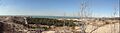
Boardwalk stairs of the Succession Trail heading down to the beach
-

Historic plaque at the Bailly Cemetery
-
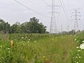
Open prairie habitat at Calumet Prairie
-
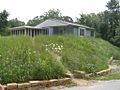
A historic prefabricated steel Lustron home in Beverly Shores
-

Topographic map and trail elevation profile of the Cowles Bog Trail
-
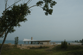
Pavilion and riverwalk at the Portage Lakefront
-
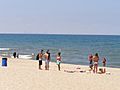
View of the distant Chicago skyline across Lake Michigan from West Beach


Related Pages
