
Indiera Fría facts for kids
Quick facts for kids
Indiera Fría
|
|
|---|---|
|
Barrio
|
|
.jpg)
Waterfall in Indiera Fría
|
|

Location of Indiera Fría within the municipality of Maricao shown in red
|
|

Indiera Fría
Location in Caribbean
|
|
| Commonwealth | |
| Municipality | |
| Area | |
| • Total | 5.84 sq mi (15.1 km2) |
| • Land | 5.84 sq mi (15.1 km2) |
| • Water | 0 sq mi (0 km2) |
| Elevation | 1,663 ft (507 m) |
| Population
(2010)
|
|
| • Total | 449 |
| • Density | 76.9/sq mi (29.7/km2) |
| Source: 2010 Census | |
| Time zone | UTC−4 (AST) |
Indiera Fría is a small community, also called a barrio, located in the town of Maricao, Puerto Rico. In 2010, about 449 people lived there.
Contents
A Look at Indiera Fría's Past
Indiera Fría is one of three special areas in Maricao known as the Indieras de Maricao. The other two are Indiera Baja and Indiera Alta. These areas were hard to reach. Because of this, they became a safe place for the Taínos people. The Taínos were the native people of Puerto Rico. They were trying to escape from the Spanish and other European colonizers. These colonizers began settling in Puerto Rico in the 1400s.
Becoming Part of the United States
After the Spanish–American War, Spain gave Puerto Rico to the United States. This happened under an agreement called the Treaty of Paris of 1898. Puerto Rico then became a territory of the United States. In 1899, the United States Department of War counted the people in Puerto Rico. They found that 1,165 people lived in the Indiera Fría barrio at that time.
| Historical population | |||
|---|---|---|---|
| Census | Pop. | %± | |
| 1900 | 1,165 | — | |
| 1960 | 849 | — | |
| 1980 | 584 | — | |
| 1990 | 508 | −13.0% | |
| 2000 | 450 | −11.4% | |
| 2010 | 449 | −0.2% | |
| U.S. Decennial Census 1899 (shown as 1900) 1910-1930 1930-1950 1960 1980-2000 2010 |
|||
Images for kids
-
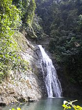
The beautiful Salto Curet waterfall in Indiera Fría.
-
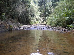
Another view of a waterfall in Indiera Fría.

.jpg)
More to Explore
 In Spanish: Indiera Fría para niños
- List of communities in Puerto Rico
