Injinoo, Queensland facts for kids
Quick facts for kids InjinooQueensland |
|||||||||||||||
|---|---|---|---|---|---|---|---|---|---|---|---|---|---|---|---|

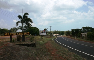
Injinoo, Cape York, Australia.
|
|||||||||||||||
| Population | 498 (2021 census) | ||||||||||||||
| • Density | 0.6601/km2 (1.710/sq mi) | ||||||||||||||
| Postcode(s) | 4876 | ||||||||||||||
| Area | 754.4 km2 (291.3 sq mi) | ||||||||||||||
| LGA(s) |
|
||||||||||||||
| State electorate(s) | Cook | ||||||||||||||
| Federal Division(s) | Leichhardt | ||||||||||||||
|
|||||||||||||||
Injinoo (which used to be called Cowal Creek) is a town located on the coast in Far North Queensland, Australia. It sits on the north-western side of the Cape York Peninsula. Injinoo is part of two local government areas: the Northern Peninsula Area Region and the Shire of Torres. In 2021, about 498 people lived in Injinoo.
History of Injinoo
The land around Injinoo has a long history. It is the traditional home of the Luthigh and Uradhi people. These are Aboriginal languages that have been spoken in this area for many years.
The Injinoo Aboriginal Community was started by a Wuthathi man named Allelic Whitesand. This community was self-sufficient, meaning they could provide for themselves by fishing and gardening. They later asked the Church of England to help them set up a mission and a school. The Queensland government allowed the community to be run by an elected Council.
After the Second World War, many Torres Strait Islanders moved to Injinoo. New settlements were built nearby at Bamaga, New Mapoon, and Umagico. This helped to relocate people who had been asked to move from Injinoo and other areas of the Cape. In 1948, a special reserve was created, and the Queensland Department of Native Affairs took control of the area.
The official name of the community was changed from Cowal Creek to Injinoo on 2 September 1989.
Population of Injinoo
The number of people living in Injinoo has changed over the years.
- In 2006, there were 416 people living in the town.
- By 2016, the population had grown to 561 people.
- In the most recent count in 2021, the population was 498 people.
Education in Injinoo
Injinoo has a school campus called the Injinoo Junior campus. It is part of the Northern Peninsula Area College. This campus teaches students from Early Childhood up to Year 6.
For older students, there are no secondary schools directly in Injinoo. The closest high school is the Senior Campus of the Northern Peninsula Area College, which is located in Bamaga. Bamaga is a town to the north-east of Injinoo.
Community Facilities
In 2012, an Indigenous Knowledge Centre was opened in Injinoo. This centre is run by the Northern Peninsula Area Regional Council. It helps to share local knowledge and culture. For example, the centre has made a video about traditional bush foods as part of a language workshop for children.
 | Misty Copeland |
 | Raven Wilkinson |
 | Debra Austin |
 | Aesha Ash |


