Innerbraz facts for kids
Quick facts for kids
Innerbraz
|
||
|---|---|---|
 |
||
|
||

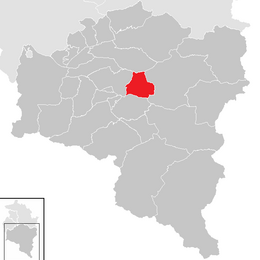
Location in the district
|
||
| Country | Austria | |
| State | Vorarlberg | |
| District | Bludenz | |
| Area | ||
| • Total | 19.97 km2 (7.71 sq mi) | |
| Elevation | 708 m (2,323 ft) | |
| Time zone | UTC+1 (CET) | |
| • Summer (DST) | UTC+2 (CEST) | |
| Postal code |
6751
|
|
| Area code | 05552 | |
| Vehicle registration | BZ | |
| Website | www.innerbraz.at | |
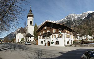
Innerbraz is a charming small town, also known as a municipality, located in the Bludenz area of the Austrian state of Vorarlberg. It's a lovely place nestled in the mountains, offering beautiful views and a quiet atmosphere.
How Many People Live Here?
The number of people living in Innerbraz has changed over many years. In 1869, about 438 people lived there. By 1951, the population had grown quite a bit to 722 people. The population continued to grow, reaching 975 people in 2001. More recently, in 2011, the population was around 950.
| Historical population | ||
|---|---|---|
| Year | Pop. | ±% |
| 1869 | 438 | — |
| 1880 | 383 | −12.6% |
| 1890 | 443 | +15.7% |
| 1900 | 464 | +4.7% |
| 1910 | 508 | +9.5% |
| 1923 | 501 | −1.4% |
| 1934 | 465 | −7.2% |
| 1939 | 478 | +2.8% |
| 1951 | 722 | +51.0% |
| 1961 | 726 | +0.6% |
| 1971 | 810 | +11.6% |
| 1981 | 844 | +4.2% |
| 1991 | 930 | +10.2% |
| 2001 | 975 | +4.8% |
| 2011 | 950 | −2.6% |
Getting Around Innerbraz
Innerbraz is easy to reach by car. It is located right along a major road called the Arlberg Schnellstraße (S16). This expressway connects the towns of Bludenz and Zams in Tyrol.
In the past, there were also train stations nearby. Two old railway stations, called Braz and Hintergasse, were once part of the Arlberg Railway line. This train line runs between Bludenz and Innsbruck Hauptbahnhof. However, these stations are no longer in use today.
See also
 In Spanish: Innerbraz para niños


