
Interstate 29 facts for kids
Quick facts for kids
|
|
|---|---|
|
I-29 highlighted in red
|
|
| Route information | |
| Length | 750.58 mi (1,207.94 km) |
| Major junctions | |
| South end | |
|
|
| North end | |
| Location | |
| States: | Missouri, Iowa, South Dakota, North Dakota |
| Highway system | |
| Main route of the Interstate Highway System Main • Auxiliary • Business |
|

Interstate 29 (I-29) is a very important Interstate Highway in the United States. It starts in Kansas City, Missouri, and goes all the way north to Pembina, North Dakota. This is right at the Canadian border! The entire road is about 755 miles (1,216 kilometers) long.
Contents
What the Route is Like
I-29 travels through four different states. Each state has its own unique scenery along the highway.
Starting in Missouri
I-29 begins its journey in Kansas City, Missouri. In this part of Missouri, the road is quite hilly. You'll see lots of forests around the highway. It then travels north through the city of St. Joseph.
Through Iowa
After Missouri, I-29 enters Iowa. Here, the highway runs very close to the Missouri River. It passes through many cities that grew up along the river. These include Council Bluffs, which is near Omaha, and Sioux City.
Across South Dakota
North of Sioux City, the highway turns west and enters South Dakota. The land here becomes very flat. You'll see wide, open plains around the highway. I-29 goes past big cities like Sioux Falls, Brookings, and Watertown.
Further north in South Dakota, the road enters an area called the Glacier Lakes. This part of the state is very hilly again.
Into North Dakota
After the hills, I-29 enters North Dakota and the land becomes flat once more. In North Dakota, I-29 runs just west of the Red River of the North. It goes through major cities like Fargo and Grand Forks.
Finally, I-29 reaches the Canadian border. This is where the highway officially ends. However, the road actually continues north into Canada. There, it is known as Manitoba Highway 29.
Images for kids
-
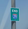
The I-29 "END" sign at its start in Kansas City.
-
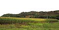
The Loess Hills are next to I-29 in Iowa.


See also
 In Spanish: Interestatal 29 para niños
