
Interstate 86 (east) facts for kids
Quick facts for kids
|
|
|---|---|
| Lua error in Module:Infobox_road/map at line 15: attempt to index field 'wikibase' (a nil value).
Map of Pennsylvania and New York with I-86 marked in red. Its future routing is marked with a dashed red line.
|
|
| Route information | |
| Maintained by PennDOT and NYSDOT | |
| Existed | December 3, 1999–present |
| Main segment | |
| Length | 196.89 mi (316.86 km) |
| West end | |
| Major junctions |
|
| East end | |
| Eastern segment | |
| Length | 9.96 mi (16.03 km) |
| West end | |
| East end | |
| Highway system | |
| Main route of the Interstate Highway System Main • Auxiliary • Business |
|

Interstate 86 (I-86) is an important Interstate Highway in the United States. It helps people travel across parts of Pennsylvania and New York. This highway is special because it's made of two separate parts.
The main part of I-86 goes from near Erie, Pennsylvania, all the way east to Elmira, New York. The second, shorter part is located further east. It runs from near Binghamton, New York, to Windsor. When you add both sections together, Interstate 86 is about 206.85 miles (332.89 km) long.
Contents
What is an Interstate Highway?
Interstate Highways are a big network of roads across the United States. They are designed for fast and safe travel over long distances. These roads are usually freeways, meaning they have no traffic lights or intersections. This allows cars to keep moving smoothly.
Connecting States and Cities
The Interstate Highway System helps connect different states and major cities. It makes it easier for people to travel for vacations or work. It also helps businesses move goods from one place to another. I-86 is part of this huge system.
Where Does Interstate 86 Go?
Interstate 86 travels through two states: Pennsylvania and New York. It's a key route for connecting communities in the southern parts of New York and a small piece of Pennsylvania.
The Western Section
The longer, western part of I-86 starts near Erie, Pennsylvania. Here, it connects with Interstate 90. From there, it heads east into New York. Along this route, it passes by cities like Salamanca, Avoca, and Corning. This section ends in Elmira, New York.
The Eastern Section
The shorter, eastern part of I-86 is located in New York. It begins near Binghamton, New York, where it meets Interstate 81. This segment then continues east for a short distance. It finishes its journey in the village of Windsor.
The Story of I-86
Interstate 86 was officially established on December 3, 1999. However, much of what is now I-86 used to be a different highway. It was known as New York State Route 17 (NY 17).
From NY 17 to I-86
Over many years, parts of NY 17 were upgraded to meet Interstate Highway standards. This meant making the road wider, safer, and faster. As sections were improved, they were re-signed as Interstate 86. This project is still ongoing in some areas. The goal is to eventually connect the two separate parts of I-86. This will create one continuous highway.
Why the Upgrade?
Upgrading NY 17 to I-86 helps improve travel and trade in the region. It provides a modern, high-speed route for drivers. This makes journeys quicker and safer for everyone using the road.
Images for kids
-
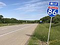
I-86 westbound past PA 89 in Greenfield Township
-
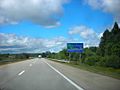
Entering Pennsylvania on I-86 westbound in Erie County
-
Signage denoting the highest point on I-86 in Almond
-
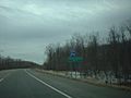
I-86 westbound in Chemung County
-

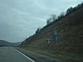
NY 17 (future I-86) at Liberty
-
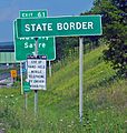
Sign along eastbound NY 17 (future I-86) marking return to New York after its brief foray into Pennsylvania.
-
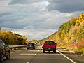
Eastbound on I-86 and southbound on US 219 near Salamanca
-
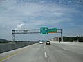
Approaching exit 53 on the westbound Horseheads Bypass (I-86)
-
A sign indicating NY 17's transition to I-86 near Goshen


