Ironton, Michigan facts for kids
Quick facts for kids
Ironton, Michigan
|
|
|---|---|

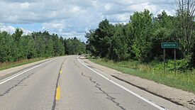
Road signage along M-66
|
|

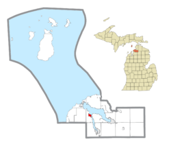
Location within Charlevoix County
|
|
| Country | United States |
| State | Michigan |
| County | Charlevoix |
| Township | Eveline |
| Settled | 1879 |
| Platted | 1884 |
| Area | |
| • Total | 1.02 sq mi (2.65 km2) |
| • Land | 1.02 sq mi (2.65 km2) |
| • Water | 0.00 sq mi (0.00 km2) |
| Elevation | 620 ft (190 m) |
| Population
(2020)
|
|
| • Total | 148 |
| • Density | 144.81/sq mi (55.91/km2) |
| Time zone | UTC-5 (Eastern (EST)) |
| • Summer (DST) | UTC-4 (EDT) |
| ZIP code(s) | |
| Area code(s) | 231 |
| FIPS code | 26-41040 |
| GNIS feature ID | 0629085 |
Ironton is a small community in Charlevoix County, Michigan. It is considered an unincorporated community and a census-designated place (CDP). This means it's a recognized area with its own population count, but it doesn't have its own city government. In 2020, 148 people lived there. Ironton is located in Eveline Township right on Lake Charlevoix. A special boat called the Ironton Ferry helps people cross a narrow part of the lake here.
History
Ironton was first settled in 1879 by a man named Robert Cherry. He worked for the Pine Lake Iron Company. In 1881, his company opened a factory in Ironton. This factory made "pig iron" from iron ore. Pig iron is a basic type of iron that is used to make other iron products. The ore was brought in by boats from the Upper Peninsula.
A post office opened in Ironton in 1881. The community was officially mapped out in 1884. However, the iron factory closed down in 1893. Even though the factory closed, people continued to live in Ironton. The post office eventually closed in 1965.
For the first time, in the 2010 census, Ironton was listed as a "census-designated place." This means it now has official borders and its population is counted separately.
Geography
Ironton is a small area, covering about 1.02 square miles (2.65 square kilometers). All of this area is land.
The community is located in the western part of Eveline Township. This township is actually split into two parts by Lake Charlevoix. The Ironton Ferry is a key part of the community. It connects these two parts of the township by crossing a narrow section of the lake.
Major highways
- M-66 is a main road that goes through Ironton. It runs from south to north.
Demographics
Demographics is the study of populations. It tells us how many people live in a place and how that number changes over time.
| Historical population | |||
|---|---|---|---|
| Census | Pop. | %± | |
| 2010 | 140 | — | |
| 2020 | 148 | 5.7% | |
| U.S. Decennial Census | |||
Education
Students in Ironton mostly attend schools in Charlevoix. These schools are part of the Charlevoix Public Schools district. Some students who live in the southwestern parts of Ironton might go to schools in East Jordan. These are part of the East Jordan Public Schools district.
See also

- In Spanish: Ironton (Míchigan) para niños
 | John T. Biggers |
 | Thomas Blackshear |
 | Mark Bradford |
 | Beverly Buchanan |


