Isanotski Strait facts for kids

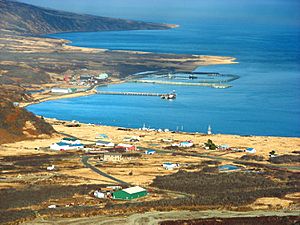
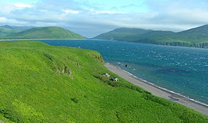
Isanotski Strait is a narrow natural waterway in Alaska. It connects the northern Gulf of Alaska with the Bering Sea. A strait is like a natural canal that links two larger bodies of water.
The name "Isanotski" comes from the Aleut word Isanax̂. This word means "gap," "hole," or "tear" in the Aleut language. Russian maps from the early 1800s also showed the strait with similar names.
Many boats shorter than 200 feet (about 61 meters) use this strait. It's a key route for ships traveling between northern Alaska and other parts of Alaska or the "lower 48" states. The small town of False Pass, Alaska is right on Isanotski Strait.

Geography of Isanotski Strait
Isanotski Strait and Ikatan Bay act like a natural border. They separate the Alaska Peninsula from Unimak Island. Unimak Island is the easternmost island in the Aleutian Islands chain.
The southern entrance to Isanotski Strait is at the northwest end of Ikatan Bay. There's a good spot for boats to anchor called Traders Cove. It's on the eastern side of the strait, about 7 miles (11 km) from the entrance.
Tides and Currents
The northern part of the strait has very strong tidal currents. These currents can get even stronger when there are powerful winds from the north or south. There's also a large shallow area, or "shoal," in the wider northern part of the strait. This shoal is east of the main channel.
Just outside the northern exit to the Bering Sea, there are more shallow areas. These shoals have breaking waves and stretch for about 5 to 6 miles (8 to 10 km). They run parallel to the coast from the northeast point of Unimak Island.
In Ikatan Bay, the average difference between high and low tide is 4.5 feet (1.4 meters). In the narrow southern part of Isanotski Strait, the tidal currents can move very fast. They can reach speeds of 7 to 9 miles per hour (11 to 14 km/h) or even more! It's said that the current almost never stops flowing, and it changes direction about three hours after high or low tide in Ikatan Bay.
History of the Strait
For thousands of years, the Aleut people used Isanotski Strait for safe travel. Later, during the time of Russian America, Russian explorers and settlers also used this waterway.
In the 1900s, the strait was important for certain boats. These were light-draft vessels, meaning they didn't need very deep water. They were built in ports like Puget Sound and used on the Yukon River. To get to places like St. Michael, Alaska, these boats would travel through inland passages in Southeast Alaska. Then they would go out through Cross Sound and sail along the coast. They would often go behind the islands off the Alaska Peninsula and pass through Isanotski Strait.
Isanotski Strait was often preferred over Unimak Pass for these river boats. It was closer and offered many sheltered places to anchor. It also had spots where they could get fresh water.
 | Ernest Everett Just |
 | Mary Jackson |
 | Emmett Chappelle |
 | Marie Maynard Daly |

