Isle Ristol facts for kids
| Gaelic name | Eilean Ruisteil |
|---|---|
| Meaning of name | 'island with the horse valley' from Gaelic and Norse. |
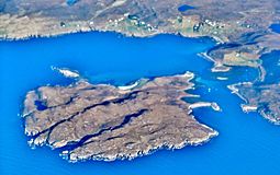
 Isle Ristol from the air |
|
| OS grid reference | NB971112 |
| Coordinates | 58°02′38″N 5°26′13″W / 58.044°N 05.437°W |
| Physical geography | |
| Island group | Summer Isles |
| Area | 225 hectares (0.87 sq mi) |
| Area rank | 103 |
| Highest elevation | 71 metres (233 ft) |
| Administration | |
| Sovereign state | United Kingdom |
| Country | Scotland |
| Council area | Highland |
| Demographics | |
| Population | 0 |
Isle Ristol is a small, special island located in Scotland. It's the island closest to the mainland in a group called the Summer Isles. This beautiful place is also a protected area, managed by the Scottish Wildlife Trust, which helps keep its nature safe.
Contents
Discovering Isle Ristol
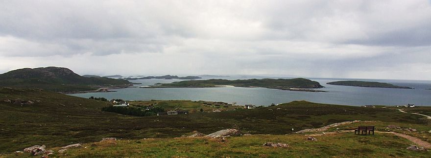
Isle Ristol is found about 12 miles (19 km) north of a town called Ullapool in an area known as Wester Ross. What makes it unique is that it's a tidal island. This means it's connected to the mainland by a narrow strip of land that gets covered by water when the tide comes in. It sits in a body of water called Loch an Alltain Duibh, separated from Old Dorney Bay by a small channel. The only way to reach Isle Ristol is by boat from Old Dornie.
What Does Isle Ristol Mean?
The name "Isle Ristol" comes from a mix of Gaelic and Norse words. It means "island with the horse valley." Even though there are no horses living there now, this name gives us a clue about its past.
How Big is Isle Ristol?
Isle Ristol covers an area of about 225 hectares (which is about 556 acres). To give you an idea, that's roughly the size of 420 football fields! The highest point on the island is 71 meters (233 feet) above sea level, which is like climbing to the top of a 20-story building. No one lives on Isle Ristol today, making it a peaceful home for wildlife.
Amazing Plants of Isle Ristol
Isle Ristol is famous for its special type of grassland called machair. This unique habitat is found mostly in the northwest of Scotland and Ireland. It's made of shell sand, which creates a very fertile soil where many different plants can grow.
Over 50 different kinds of plants have been found on Isle Ristol's machair. Some of these are quite rare and interesting. For example, you can find:
- Moonwort (Botrychium): This small fern has a single leaf that looks a bit like a half-moon.
- Adder's Tongue (Ophioglossum): Another type of fern, its leaf looks a bit like a snake's tongue.
These plants show how special the environment on Isle Ristol is.
A Glimpse into History
In the late 1700s, Isle Ristol was an important place for fishing. The British Fishery Society had a station there. This means it was a busy spot where people would process and prepare fish, likely for trade. It played a role in the fishing industry of Scotland during that time.
 | Shirley Ann Jackson |
 | Garett Morgan |
 | J. Ernest Wilkins Jr. |
 | Elijah McCoy |


