Jerimoth Hill facts for kids
Quick facts for kids Jerimoth Hill |
|
|---|---|

Jerimoth Hill Summit
|
|
| Highest point | |
| Elevation | 811 ft (247 m) NGVD 29 |
| Prominence | 192 ft (59 m) |
| Listing | U.S. state high point 46th |
| Geography | |
| Location | Foster, Rhode Island, US |
| Topo map | USGS East Killingly, CT |
| Climbing | |
| Easiest route | Highway (RI 101) |
Jerimoth Hill is the highest point in the U.S. state of Rhode Island. It stands about 812 feet (247 meters) tall. This special spot is in the town of Foster, in the northwest part of the state.
Jerimoth Hill is used as an observatory by Brown University. It's also a popular place for "highpointers." These are hikers who try to visit the highest natural point in different states or regions. For many years, it was hard to visit Jerimoth Hill because a private landowner blocked the way. But now, it's open for everyone to enjoy!
Contents
Where is Jerimoth Hill Located?
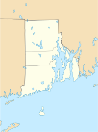
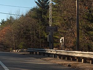
Jerimoth Hill is found right off Route 101 in Foster. It's only about half a mile from the border with Connecticut.
To reach the very top of the hill, there's a short path. This trail is about 0.3 miles (480 meters) long. It's a very easy walk, as the path only goes up about 10 feet (3 meters). The hill is about 15 miles (24 km) west of Providence, Rhode Island. It's also about 35 miles (56 km) east of Willimantic, Connecticut.
The Story of Jerimoth Hill
Jerimoth Hill got its name from Jerimoth Brown. He was an early settler who lived from 1783 to 1830.
Years ago, a man named Walter Raymond Turner gave the high point to Brown University. He was a graduate of Brown University from the class of 1911. In 1938, he bought the land around the hill. He also made sure there was a path from the hill to Route 101. However, this path eventually became overgrown.
Why is Jerimoth Hill an Observatory?
Brown University has used Jerimoth Hill for astronomy for a long time. It's a great spot for looking at the stars. This is because the land is easy for the university to reach. Also, it's far from city lights, so there's less light pollution. This means the sky is much darker, making it easier to see stars and planets.
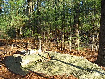
The top of the hill has an open area. Pine trees were cleared from a space of about 200 square feet (18.5 square meters). The highest point itself is a rocky area in the woods. There's even a special mailbox at the top. Visitors can sign a "summit register" inside it to show they reached the peak.
How Access to the Hill Changed
As the highest point in Rhode Island, Jerimoth Hill is a goal for many "highpointers." For many years, it was very hard for hikers to get to the hill. The only way to the top was across private land. The landowner, Henry Richardson, did not allow people to cross his property. He put up "no trespassing" signs. He even had a security system that would alert him if anyone entered his land.
Mr. Richardson's strict rules about access made him well-known among hikers. Eventually, his son worked out a plan. This allowed people to visit the path four times a year. After Mr. Richardson passed away, the Mosley family bought his property in 2005. They were much more welcoming. They allowed daily access to the hill. Later, they gave the land to the state of Rhode Island.
In 2014, Brown University also sold the very top of the hill to the state. However, the university still has the right to build an observatory there in the future. This means Jerimoth Hill is now open for everyone to visit and enjoy!
 | Calvin Brent |
 | Walter T. Bailey |
 | Martha Cassell Thompson |
 | Alberta Jeannette Cassell |


