John Paul Hammerschmidt Lake facts for kids
Quick facts for kids John Paul Hammerschmidt Lake |
|
|---|---|
| Coordinates | 35°21′09″N 94°17′44″W / 35.352586°N 94.295629°W |
| Etymology | navigational reservoir |
| Part of | McClellan-Kerr Arkansas River Navigation System (MKARNS) |
| River sources | Arkansas River, Poteau River |
| Basin countries | United States |
| Managing agency | U.S. Army Corps of Engineers |
| Max. length | 26 miles (42 km) |
| Surface area | 7,700 acres (31 km2) |
| Shore length1 | 120 miles (190 km) |
| Surface elevation | 392 feet (119 m) |
| Settlements | Fort Smith, Arkansas, Van Buren, Arkansas, Barling, Arkansas, Moffett, Oklahoma, Fort Coffee, Oklahoma |
| 1 Shore length is not a well-defined measure. | |
John Paul Hammerschmidt Lake is a large, man-made lake, also called a reservoir. It was created on the Arkansas River and is a very important part of the McClellan–Kerr Arkansas River Navigation System (often called MKARNS). This system helps boats and barges travel along the river.
The lake was formed when the James W. Trimble Lock & Dam 13 was built across the river. This dam is near the city of Barling, Arkansas. The lake stretches about 26 miles (42 km) upstream to another dam called the W. D. Mayo Lock and Dam, which is in Oklahoma. Even though the Trimble dam was finished in 1969, large commercial boats couldn't use it until 1971. This was because other parts of the navigation system further upstream needed to be completed first.
Contents
The McClellan–Kerr Arkansas River Navigation System (MKARNS) is a huge waterway. It allows boats and barges to travel from the Mississippi River all the way to ports in Oklahoma. This system helps transport goods and materials, which is important for trade and the economy.
The system uses a series of "locks" and "dams." A dam holds back water to create a lake, like John Paul Hammerschmidt Lake. A lock is like a water elevator for boats. It raises or lowers boats so they can move between different water levels along the river.
Where is John Paul Hammerschmidt Lake Located?
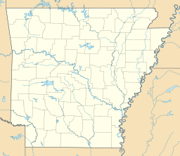
John Paul Hammerschmidt Lake is located right on the border between two states: Arkansas and Oklahoma.
Counties and Cities Along the Lake
In Arkansas, the lake acts as a border between Crawford County and Sebastian County. It also separates two important cities: Van Buren (the main city of Crawford County) and Fort Smith (the main city of Sebastian County).
About half of the lake's length is actually in Oklahoma. There, it separates Sequoyah County, Oklahoma from LeFlore County, Oklahoma.
Rivers Flowing into the Lake
The Poteau River is a river that flows north through Oklahoma. It crosses into Arkansas just southwest of Fort Smith. The Poteau River then flows into John Paul Hammerschmidt Lake, adding to its waters.
How High is the Lake?
The normal water level of John Paul Hammerschmidt Lake is about 392 feet (119 m) above sea level. This elevation is carefully managed by the U.S. Army Corps of Engineers to keep the navigation system working smoothly.


