Fort Coffee, Oklahoma facts for kids
Quick facts for kids
Fort Coffee, Oklahoma
|
|
|---|---|

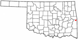
Location of Fort Coffee, Oklahoma
|
|
| Country | United States |
| State | Oklahoma |
| County | Le Flore |
| Government | |
| • Type | Town |
| Area | |
| • Total | 6.53 sq mi (16.91 km2) |
| • Land | 6.53 sq mi (16.91 km2) |
| • Water | 0.00 sq mi (0.01 km2) |
| Elevation | 449 ft (137 m) |
| Population
(2020)
|
|
| • Total | 335 |
| • Density | 51.33/sq mi (19.82/km2) |
| Time zone | UTC-6 (Central (CST)) |
| • Summer (DST) | UTC-5 (CDT) |
| FIPS code | 40-27150 |
| GNIS feature ID | 2412639 |
Fort Coffee is a small town in Le Flore County, Oklahoma, United States. It was first built as a U.S. Army fort in 1834. The fort was named after General John Coffee, who was a hero from the Seminole Wars.
Fort Coffee is part of the larger Fort Smith, Arkansas-Oklahoma area. In 2020, about 335 people lived there.
Contents
The Story of Fort Coffee
The town of Fort Coffee started in 1832. This was when the Choctaw Indian tribe moved from the southeastern United States. They traveled to a new area called Indian Territory, which is now part of Oklahoma. Most of their journey was by water, and the spot where Fort Coffee now stands became a busy port on the Arkansas River.
Building the Fort
In 1834, the Choctaw Nation asked the U.S. War Department for help. They wanted a fort built to stop illegal goods, like alcohol, from coming into their land. The fort was successful in its mission. Soldiers also built roads connecting Fort Coffee to other forts like Fort Smith, Arkansas, Fort Gibson, and Fort Towson. The army left Fort Coffee in 1838 when Fort Smith was reopened.
From Fort to School
In 1843, the Choctaw Nation allowed the Methodist Episcopal church to use the fort's buildings. They opened the Fort Coffee Choctaw Boys Academy. This school taught boys until the American Civil War began. During the war, soldiers led by General Stand Watie took over the site. The Union Army later recaptured the fort in 1863. Many of the buildings were burned down during this time. Later, small houses were built using the old foundation stones.
After the War
After the Civil War, the Choctaw were required to free their slaves. Many of these freed people stayed in the Choctaw Nation. In 1885, many were officially adopted into the Choctaw Nation. This meant they could receive land.
Local Economy
For a long time, the main way people made a living in Fort Coffee was through farming. Farmers grew crops like cotton, raised livestock, and later grew soybeans. There was even a cotton gin in town to process the cotton. Trains from the Fort Smith and Western Railroad and the Kansas City, Pittsburg and Gulf Railway (now part of the Kansas City Southern Railway) helped transport these farm products to other places.
Fort Coffee officially became a town in 1998.
Where is Fort Coffee?
Fort Coffee is located about 6 miles (10 km) northeast of Spiro.
The town covers an area of about 6.4 square miles (16.9 square kilometers). Most of this area is land, with a very small amount of water.
It sits just south of a bend in the Arkansas River. This is downstream from the Robert S. Kerr Reservoir. The town is also north of U.S. Route 271. It's about 11 miles (18 km) from the border with Arkansas.
People in Fort Coffee
| Historical population | |||
|---|---|---|---|
| Census | Pop. | %± | |
| 2000 | 412 | — | |
| 2010 | 424 | 2.9% | |
| 2020 | 335 | −21.0% | |
| U.S. Decennial Census | |||
Every ten years, the United States counts its population in a census. In 2000, there were 412 people living in Fort Coffee. By 2010, the population grew slightly to 424. However, in the 2020 census, the population was 335 people.
In 2000, there were 163 households in the town. About 30% of these households had children under 18 living there. The average household had about 2.5 people.
The median age in Fort Coffee in 2000 was 41 years old. This means half the people were younger than 41, and half were older.
Fun Places to Visit
Even though the mailing address for Spiro, Oklahoma is used, the famous Spiro Mounds and the Spiro Mounds Archaeological Center are actually in Fort Coffee. These mounds are ancient Native American sites.
The W. D. Mayo Lock and Dam is just northeast of town. This is part of a big system that helps boats travel on the Arkansas River. There's also a boat ramp nearby where you can access the river.
Images for kids
See also
 In Spanish: Fort Coffee (Oklahoma) para niños
 | Selma Burke |
 | Pauline Powell Burns |
 | Frederick J. Brown |
 | Robert Blackburn |


