Joinville Island group facts for kids
|
Nickname: PeePee Islands
|
|
|---|---|

Satellite picture of the group
|
|

Joinville Island group:
|
|
| Geography | |
| Location | Antarctica |
| Coordinates | 63°15′S 55°45′W / 63.250°S 55.750°W |
| Archipelago | Joinville Island group |
| Administration | |
| Administered under the Antarctic Treaty System | |
| Demographics | |
| Population | Uninhabited |
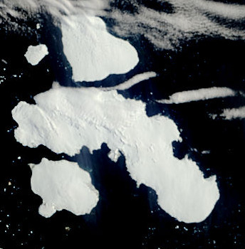
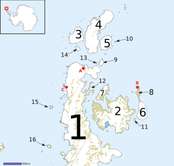
The Joinville Island group is a collection of islands. They are located near the northeastern tip of the Antarctic Peninsula. A stretch of water called the Antarctic Sound separates them from the mainland. The largest island in this group is Joinville Island itself. Just north of Joinville Island is D'Urville Island, Antarctica, which is the northernmost island of the group.
Geography
The Joinville Island group is found off the coast of the Antarctic Peninsula. This area is part of Antarctica, the coldest continent on Earth. The islands are surrounded by icy waters. The Larsen Channel separates Joinville Island from D'Urville Island, Antarctica. These islands are not home to any people. They are part of the Antarctic Treaty System. This treaty makes sure Antarctica is used only for peaceful, scientific purposes.
Discovery
The Joinville Island group was first seen in 1838. A French expedition discovered them. This expedition was led by Captain Jules Dumont d'Urville. He was a famous explorer. He named the main island, Joinville Island, after a French prince.
See also
In Spanish: Archipiélago de Joinville para niños
 | Delilah Pierce |
 | Gordon Parks |
 | Augusta Savage |
 | Charles Ethan Porter |

