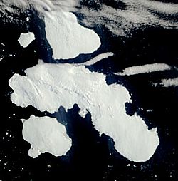
Joinville Island facts for kids
 |
|
| Geography | |
|---|---|
| Location | Antarctica |
| Coordinates | 63°15′S 55°45′W / 63.250°S 55.750°W |
| Archipelago | Joinville Island group |
| Area | 1,607 km2 (620 sq mi) |
| Length | 74 km (46 mi) |
| Width | 22 km (13.7 mi) |
| Administration | |
| Administered under the Antarctic Treaty System | |
| Demographics | |
| Population | 0 |
Joinville Island is the biggest island in the Joinville Island group. It is about 74 kilometers (40 nautical miles) long from east to west and 22 kilometers (12 nautical miles) wide. This island is located near the northeastern tip of the Antarctic Peninsula. The Antarctic Sound separates Joinville Island from the main peninsula.
Contents
Discovering Joinville Island
A French team led by Captain Jules Dumont d'Urville found and mapped Joinville Island in 1838. Captain d'Urville named the island after Prince François, Prince of Joinville. Prince François (1818–1900) was the third son of Louis Philippe I, who was the Duke of Orléans.
Where is Joinville Island?
Joinville Island is part of the land claimed by three different countries. These claims are from Argentina (called Argentine Antarctica), the United Kingdom (called British Antarctic Territory), and Chile (called Chilean Antarctic Territory). However, all claims in Antarctica are managed under the Antarctic Treaty System. This treaty means that Antarctica is used only for peaceful, scientific purposes.
What is Joinville Island like?
The island has many different valleys and bays. Some of these include Suspiros Bay and Balaena Valley. Like much of Antarctica, Joinville Island is very cold and covered in ice. No people live on the island permanently.
See also
 In Spanish: Isla Joinville para niños
 | John T. Biggers |
 | Thomas Blackshear |
 | Mark Bradford |
 | Beverly Buchanan |


