Kaiti, New Zealand facts for kids
Quick facts for kids
Kaiti
|
|
|---|---|
|
Suburb
|
|

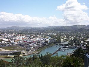
A picture of Kaiti
|
|
| Country | New Zealand |
| Local authority | Gisborne |
| Electoral ward | Tairāwhiti General Ward |
| Area | |
| • Land | 620 ha (1,530 acre) |
| Population
(June 2023)
|
|
| • Total | 8,650 |
|
|
||
Kaiti (which means "to eat the edible parts of cabbage trees" in Māori) is a suburb in Gisborne, New Zealand. It is located just east of the city centre. The Waimata River separates Kaiti from the main part of Gisborne.
Kaiti is also home to Kaiti Hill, also known as Titirangi. This hill looks out over Poverty Bay and the city of Gisborne. You can also see Young Nick's Head across the bay. The Turanganui River flows below the hill, marking another boundary between Kaiti and Gisborne's central area.
Kaiti Beach is a very important historical place in New Zealand. It is where the Horouta waka (a large Māori canoe) landed. This waka brought the ancestors of the local tangata whenua (the original people of the land) to the region. Later, in 1769, Captain James Cook also landed here. He was the first European to step foot on New Zealand soil. The exact spot where he landed is now a protected national reserve called the Cook Landing Site.
Contents
People and Population in Kaiti
Kaiti covers an area of about 6.20 square kilometers. As of June 2023, about 8650 people live here. This means there are about 1395 people living in each square kilometer.
The population of Kaiti has grown over the years. In 2018, there were 7,803 people living here. This was an increase of 912 people since 2013, and 279 people since 2006.
Kaiti is a diverse community. In 2018, about 67.7% of the people identified as Māori. About 43.5% identified as European/Pākehā. There were also people from Pacific backgrounds (7.5%) and Asian backgrounds (2.7%). Some people identified with more than one ethnicity.
Exploring Kaiti's Geography
Kaiti has several great outdoor spaces for everyone to enjoy.
Titirangi Hill: A Place to Explore
Titirangi Hill is a wonderful reserve. It has areas for walking dogs and a fitness trail if you like to exercise. There are also picnic spots and a playground for younger kids. The hill offers amazing lookout points with fantastic views of the surrounding area.
At the bottom of Titirangi Hill, you'll find the Kaiti Beach reserve. This is a lovely beach area that also serves as a local park. It's another great spot for walking dogs.
Other Parks in Kaiti
Kaiti has several other parks that offer different activities:
- Anzac Park: This park has a barbecue area for cooking outdoors and a boat ramp for launching boats. It also has football fields, more picnic areas, and a playground.
- Waikirikiri Reserve: This is a large sports ground perfect for games. It also has areas for dog walking and a picnic area.
- London Street Reserve: A smaller local park, also suitable for walking dogs.
Marae: Important Meeting Places
Te Poho-o-Rawiri Marae is a very important place in Kaiti. A marae is a traditional Māori tribal meeting ground. Te Poho-o-Rawiri Marae belongs to the Ngāti Porou hapū (sub-tribes) of Ngāti Konohi and Ngāti Oneone. It includes a special meeting house called Te Poho o Rawiri.
In 2020, the government helped fund upgrades to Te Poho-o-Rawiri Marae and five other marae in the region. This project helped create jobs and improve these important community spaces.
Schools in Kaiti
Kaiti has several schools for different age groups:
- Kaiti School: This is a primary school for students in Year 1 to Year 6. It has about 400 students.
- Te Wharau School: Another primary school for Year 1 to Year 6 students, with about 337 students.
- Ilminster Intermediate: This school is for older primary students, covering Year 7 and Year 8. It has about 108 students.
- Waikirikiri School: This primary school teaches students from Year 1 to Year 8. It has about 183 students.
All these schools welcome both boys and girls. The student numbers are from February 2024. .
 | DeHart Hubbard |
 | Wilma Rudolph |
 | Jesse Owens |
 | Jackie Joyner-Kersee |
 | Major Taylor |


