Kandiyohi, Minnesota facts for kids
Quick facts for kids
Kandiyohi
|
|
|---|---|

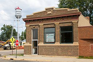
Historic Kandiyohi Bank
|
|

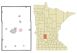
Location of Kandiyohi, Minnesota
|
|
| Country | United States |
| State | Minnesota |
| County | Kandiyohi |
| Area | |
| • Total | 0.39 sq mi (1.01 km2) |
| • Land | 0.39 sq mi (1.01 km2) |
| • Water | 0.00 sq mi (0.00 km2) |
| Elevation | 1,221 ft (372 m) |
| Population
(2020)
|
|
| • Total | 569 |
| • Density | 1,455.24/sq mi (562.55/km2) |
| Time zone | UTC-6 (Central (CST)) |
| • Summer (DST) | UTC-5 (CDT) |
| ZIP code |
56251
|
| Area code(s) | 320 |
| FIPS code | 27-32372 |
| GNIS feature ID | 2395488 |
Kandiyohi is a small city in Kandiyohi County, Minnesota, in the United States. In 2020, about 569 people lived there. It's a quiet place with a cool history!
Contents
A Look Back: Kandiyohi's History
Kandiyohi was founded in 1869. This happened when the railroad tracks were built to reach this spot.
Did you know that in 1869, the state government of Minnesota almost chose Kandiyohi to be the new state capital? A bill was passed to make it the capital because it was in a central location. However, the governor at the time, William Rainey Marshall, stopped the plan. He thought the capital should be closer to where most people would live in the future.
The name "Kandiyohi" comes from a Sioux word. It means "where the buffalo fish come from."
Exploring Kandiyohi: Geography
Kandiyohi is a small city, covering about 1.01 square kilometers (0.39 square miles) of land. It has no water area within its city limits.
The city is home to five parks that are great for families. A major road, U.S. Route 12, runs through the community.
Who Lives Here: Population Facts
The number of people living in Kandiyohi has changed over the years. Here's a quick look at how the population has grown:
| Historical population | |||
|---|---|---|---|
| Census | Pop. | %± | |
| 1880 | 75 | — | |
| 1910 | 185 | — | |
| 1920 | 184 | −0.5% | |
| 1930 | 192 | 4.3% | |
| 1940 | 271 | 41.1% | |
| 1950 | 293 | 8.1% | |
| 1960 | 312 | 6.5% | |
| 1970 | 295 | −5.4% | |
| 1980 | 447 | 51.5% | |
| 1990 | 506 | 13.2% | |
| 2000 | 555 | 9.7% | |
| 2010 | 491 | −11.5% | |
| 2020 | 569 | 15.9% | |
| U.S. Decennial Census | |||
Kandiyohi's Population in 2010
In 2010, about 491 people lived in Kandiyohi. There were 202 households, which means 202 different homes or families.
Many homes (about 33.7%) had children under 18 living there. Most households (53%) were married couples living together. The average household had about 2.42 people.
The average age of people in the city was 32.6 years old. About 28.1% of residents were under 18. Also, 11.4% of the people were 65 years old or older. The city had slightly more males (50.5%) than females (49.5%).
Famous Faces from Kandiyohi
Some notable people have connections to Kandiyohi:
- Mary Lou Freeman, who became a state legislator in Iowa, was born in Kandiyohi.
- Eugene Peter Knudsen, a farmer and state legislator in Minnesota, lived in Kandiyohi.
See also
 In Spanish: Kandiyohi para niños

