Kangaamiut facts for kids
Quick facts for kids
Kangaamiut
Gammel Sukkertoppen
|
|
|---|---|

Kangaamiut
|
|
| State | |
| Constituent country | |
| Municipality | |
| Founded | 1755 |
| Population
(2020)
|
|
| • Total | 293 |
| Time zone | UTC-03 |
| Postal code |
3912 Maniitsoq
|
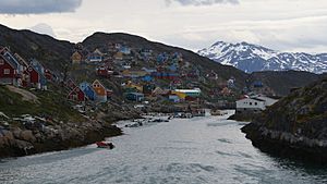
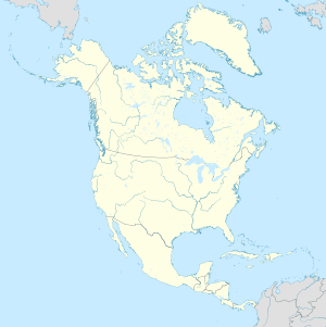
Kangaamiut, once called Gammel Sukkertoppen, is a small town in central-western Greenland. In 2020, about 293 people lived there. It is part of the Qeqqata municipality, which is a local government area in Greenland.
Contents
Where is Kangaamiut Located?
Kangaamiut is found on an island near the Davis Strait. It sits between two long fjords, which are narrow inlets of the sea. To the south is the long and winding Kangerlussuatsiaq Fjord. To the north is the Kangaamiut Kangerluarsuat Fjord. Another large fjord, Kangerlussuaq Fjord, is about 26 kilometers (16 miles) north of the island.
A Brief History of Kangaamiut
Kangaamiut has an interesting past. The area where Kangaamiut is today was once home to a Dano-Norwegian settlement called Sukkertoppen. This settlement was started in 1755. However, in 1782, Sukkertoppen was moved to its current location, which is now the town of Maniitsoq.
How People Travel to Kangaamiut
Kangaamiut is a stop for the Arctic Umiaq Line coastal ship. This ship travels along the coast, connecting different towns and settlements in Greenland. It's an important way for people and goods to move around.
Kangaamiut's Population Changes
The number of people living in Kangaamiut has gone down quite a bit over the years. Since 1990, the town has lost more than 36% of its residents. Compared to the year 2000, the population has decreased by over 26%. This means fewer people are living in Kangaamiut now than in the past.
See Also
 In Spanish: Kangaamiut para niños
 | Dorothy Vaughan |
 | Charles Henry Turner |
 | Hildrus Poindexter |
 | Henry Cecil McBay |


