Kangerlussuaq Fjord facts for kids
Quick facts for kids Kangerlussuaq Fjord |
|
|---|---|
| Søndre Strømfjord | |
| Location | Arctic |
| Coordinates | 66°30′N 52°7′W / 66.500°N 52.117°W |
| Ocean/sea sources | Davis Strait |
| Basin countries | Greenland |
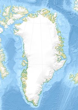
Kangerlussuaq Fjord is a very long and important fjord in western Greenland. A fjord is a long, narrow arm of the sea, usually with steep sides, created by a glacier. This fjord is about 190 kilometers (118 miles) long. It stretches from the mouth of the Qinnguata Kuussua river all the way to the Davis Strait. It is the longest fjord in western Greenland.
Contents
What is Kangerlussuaq Fjord?
Kangerlussuaq Fjord is located in the Qeqqata area of central-western Greenland. Its name in Danish is Søndre Strømfjord. The fjord is quite wide, ranging from 1.5 kilometers (0.9 miles) to 8 kilometers (5 miles) across. It flows towards the southwest and eventually opens into the Davis Strait, which is part of the Atlantic Ocean.
Geography of the Fjord
The very beginning of the fjord is where the Qinnguata Kuussua river flows into it. This river carries meltwater from the huge Greenland ice sheet, also known as Sermersuaq. The end of the fjord, where it meets the sea, is located south of Simiutaq Island. There is also a smaller waterway that connects to the sea north of this island.
Unique Coastline
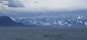
Unlike many other fjords, Kangerlussuaq Fjord does not have smaller fjords branching off it. Its coastline is mostly smooth and even. The inner parts of the fjord are surrounded by small hills. These hills gradually turn into steep mountains as you get closer to the mouth of the fjord. This is different from fjords in Norway or even other parts of Greenland, where mountains often get smaller towards the sea.
Emerald Waters
The water in Kangerlussuaq Fjord has a special emerald green color near its start. This is because the Qinnguata Kuussua river carries a lot of fine sand and mud, called sediment, from the melting ice sheet. This sediment makes the water look distinctly green for several kilometers. Near the river mouth, this buildup of sediment has also created areas of quicksand. These quicksand patches can be up to a kilometer long within the fjord.
Bordering Lands
This fjord also acts as a natural border between two geographic areas: Queen Ingrid Land and King Frederick IX Land.
Settlements Near the Fjord
There is only one main settlement directly on the shores of Kangerlussuaq Fjord. This is the town of Kangerlussuaq, which is located just north of where the river enters the fjord. Another town, Kangaamiut, is found on a small island in the Davis Strait. It is about 26 kilometers (16 miles) south of the fjord's entrance.
Travel and Transport
The entire length of Kangerlussuaq Fjord is safe for ships to travel through. Large cruise ships, like those from Norway's Hurtigruten line, use the fjord. Supply ships from Royal Greenland also navigate the fjord. These ships dock at the Kangerlussuaq port, which is located west of the Kangerlussuaq Airport.
 | Claudette Colvin |
 | Myrlie Evers-Williams |
 | Alberta Odell Jones |


