
Kantishna, Alaska facts for kids
Quick facts for kids
Kantishna, Alaska
|
|
|---|---|

Kantishna
|
|
 |
|

Kantishna, Alaska
Location in Alaska
|
|
| Country | United States |
| State | Alaska |
| Borough | Denali |
| Elevation | 1,696 ft (517 m) |
| Time zone | UTC-9 (Alaska (AKST)) |
| • Summer (DST) | UTC-8 (AKDT) |
| ZIP codes |
Kantishna is one of the sparsely-populated communities in Alaska that do not have a zip code.
|
| GNIS feature ID | 1404435 |
Kantishna is a small community in Denali Borough, Alaska, United States. It is located inside Denali National Park and Preserve. Kantishna started as a gold mining camp in 1905. It was built very close to where the gold was found, which helped it last longer than other mining towns nearby.
The community is in the Kantishna Hills, where Eureka Creek and Moose Creek meet. It is about 3 miles (5 km) northwest of Wonder Lake and close to the Kantishna River. Even though it was once called "Eureka," the official name became "Kantishna" in 1944. This was the name of the post office built there in 1905. Kantishna is about 1,696 feet (517 m) above sea level.
Contents
Getting to Kantishna
Kantishna is a remote area, meaning it's far away from other towns. There are a few lodges where visitors can stay, like the Denali Backcountry Lodge, Kantishna Roadhouse, or Camp Denali/North Face Lodge.
- Bus Travel: To reach these lodges, guests usually take a bus from the Denali Park Train Depot. This trip is about 92.5 miles (149 km) long and takes more than six hours.
- No Private Cars: Regular cars are not allowed to drive into the inner parts of Denali National Park. This helps protect the park's wildlife and environment.
- Air Travel: You can also fly to Kantishna. A company called Kantishna Air Taxi offers chartered flights to Kantishna Airport.
Gold Mining History
Thousands of prospectors (people looking for gold) came to the Kantishna Hills in 1905. This happened after placer gold was found in Glacier Creek by Joe Quigley and Jack Horn. Placer gold is gold found in loose sand or gravel, often in riverbeds. Other miners also found gold nearby in Friday Creek and Eureka Creek.
Soon, mining towns like Glacier, Diamond, Roosevelt, and Square Deal grew in the area. However, by 1906, most of these towns were empty. By 1916, only about 35 people lived in the region, and half of them were men working on gold claims.
Where the Gold Came From
The gold found in Kantishna came from a type of rock called Birch Creek schist. This schist has quartz veins (cracks filled with quartz) that contain gold, silver, and antimony. This schist is the oldest rock formation in the area.
Mining in Kantishna stopped in 1985. This was because the mining district became part of the national park, which aims to protect the natural environment.
-
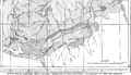
A Geologic map of the Kantishna Region, showing different rock types.
-
The legend for the Kantishna Region Geologic Map, explaining the symbols.
-
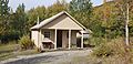
The home of Fannie Quigley, a famous miner in Kantishna.
-
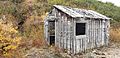
The Little Annie Mine, located on Quigley Ridge.


Quigley Ridge and the Miners
The ridge between Eureka and Friday Creeks is known as Quigley Ridge. It was named after Joe and Fannie Quigley, who were famous gold miners in the area. They searched for gold and silver here.
- Early Claims: In 1910, they started filing hard rock claims (rights to mine in a specific area) on the ridge. Fannie also had claims for placer gold in Friday and Eureka Creeks.
- Little Annie Mine: Fannie bought the Little Annie Claim in 1914. Miners dug a tunnel into the ridge, finding a quartz vein with gold.
- Red Top Lode: Joe Quigley worked on the Red Top Lode (a vein of ore). He dug a shaft (a vertical tunnel) and a drift (a horizontal tunnel) to follow the gold vein.
- Later Operations: In 1935, two men, Ernest R. Fransen and Clifton M. Hawkins, bought 17 of the Quigleys' claims. Joe and Fannie received a lot of money from this sale. Fransen and Hawkins started the Red Top Mining Company. They built an access road, bunkhouses for workers, and a blacksmith shop.
- End of Mining: The company operated until 1942, when WWII (World War II) caused gold mining to stop.
- Quigley Homestead: The Quigley family also had their home and cabin on this ridge from about 1913 to 1939. Later, Fannie moved closer to the Kantishna airstrip.
See also
 In Spanish: Kantishna para niños
