
Geological map facts for kids

A geological map is a special kind of map that shows what the Earth is made of. It helps us see different types of rocks and how they are arranged, both on the surface and deep underground. These maps are super useful for geologists, scientists who study the Earth.
The very first geological map of England was created by a scientist named William Smith. His work helped people understand the layers of rock beneath their feet.
Contents
What Geological Maps Show
Geological maps use different colors and symbols to show where various types of rocks are found. Imagine looking down on the Earth from above; the map shows you which rocks are exposed at the surface.
Layers of Rock
The Earth is made of many layers, like a giant cake. These layers are called strata. On a geological map, you can see how these layers are stacked up.
Faults and Folds
Geological maps also show important features like faults and folds.
- Faults are giant cracks in the Earth's crust where rocks have moved past each other.
- Folds are bends or curves in the rock layers, often caused by huge forces pushing on the Earth.
Symbols on the map tell you how these faults and folds are angled or tilted.

Seeing Underground
Sometimes, geological maps use special lines, like contour lines, to show what rock layers look like underground. This helps geologists understand the shape of these layers even when they are buried. Other maps, called isopach maps, show how thick different rock layers are.
It's not always easy to map everything perfectly. Sometimes, rock layers are broken up, mixed together, or have parts missing because of erosion.
Related pages

Images for kids
-
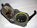
A standard Brunton Geological compass, used commonly by geologists
-
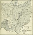
Geological Map of Ohio from "Geography of Ohio," 1923

_(cropped).jpg)
See also
 In Spanish: Mapa geológico para niños
