Kapiti Coast Airport facts for kids
Quick facts for kids
Kapiti Coast Airport
|
|||||||||||||||||||
|---|---|---|---|---|---|---|---|---|---|---|---|---|---|---|---|---|---|---|---|

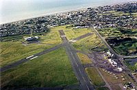
Aerial view of Kapiti Coast Airport looking towards Paraparaumu Beach
|
|||||||||||||||||||
| Summary | |||||||||||||||||||
| Airport type | Attended, Uncontrolled, Certificated Aerodrome | ||||||||||||||||||
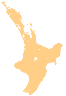
| Location | Paraparaumu, Greater Wellington region | ||||||||||||||||||
| Elevation AMSL | 7 m / 22 ft | ||||||||||||||||||
| Coordinates | 40°54′17″S 174°59′21″E / 40.90472°S 174.98917°E | ||||||||||||||||||
| Map | |||||||||||||||||||
| Runway | |||||||||||||||||||
|
|||||||||||||||||||
Kapiti Coast Airport (IATA: PPQ, ICAO: NZPP) is an airport on the Kapiti Coast in New Zealand. It is located on the North Island, near the towns of Paraparaumu Beach, Paraparaumu, and Raumati Beach. A small stream called Wharemauku flows through part of the airport's land.
This airport used to be called Paraparaumu Airport. It was once the main airport for the greater Wellington region. This was before Wellington Airport reopened in 1959. The airport was owned by the New Zealand government until 1995, when it became a private airport.
Contents
History of the Airport
Building the Airport
The Royal New Zealand Air Force built this airport in July 1939. They used equipment from another airport called Whenuapai. The government made it an "Emergency Airport" for planes to use if needed.
Becoming Wellington's Main Airport
From 1947 to 1959, the main airport in Wellington, Rongotai Airport, was closed. Its grass runways often became too muddy in winter. Because of this, the National Airways Corporation (NAC) had to move its flights to Paraparaumu Airport. Even though it was 35 miles from Wellington, Paraparaumu became the busiest airport in New Zealand in 1949. Many planes, like DC-3s and Lodestars, were often lined up there.
Challenges and Changes
In the 1950s, experts decided Paraparaumu was not good for international flights. This was because Kapiti Island was too close to the west. Also, the Tararua Ranges were very close to the east. These natural features made it hard for large planes to take off and land safely. Houses were also built very close to the airport.
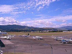
In 1959, the improved Rongotai Airport in Wellington reopened. After this, Paraparaumu Airport stopped being Wellington's main airport. It became a place mainly for smaller, private planes and flight training. The Kapiti Aero Club is based here, along with other private flying groups.
New Ownership and Plans
In 1995, the airport became privately owned. In 2007, it was sold to a property developer named Sir Noel Robinson. Later, in December 2019, it was sold again to the Templeton Group.
Because the Kapiti Coast area is growing fast, there has been new interest in having commercial flights from the airport. Many people who work in Wellington live here. This led to plans to improve the airport. These plans included building a new terminal and changing some runways. The control tower was also reopened in 2011.
Return of Commercial Flights
On October 24, 2011, Air Nelson, which is part of Air New Zealand, started flying from Paraparaumu to Auckland. Flights to Christchurch also began in November 2013 but stopped in February 2016. All these flights used 50-seat Bombardier Q300 planes. However, Air New Zealand stopped all its flights from Kapiti Coast on April 3, 2018.
After Air New Zealand left, Air Chathams showed interest in flying from Paraparaumu to Auckland. They started offering 36 flights per week from August 20, 2018. They use a Saab 340 aircraft for these flights.
Airlines and Destinations
Passenger Flights
| Airlines | Destinations |
|---|---|
| Air Chathams | Auckland |
| Sounds Air | Blenheim, Nelson |
 | Anna J. Cooper |
 | Mary McLeod Bethune |
 | Lillie Mae Bradford |


