Karnali Pradesh facts for kids
Quick facts for kids
Karnali Pradesh
कर्णाली प्रदेश
|
|
|---|---|
|
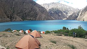
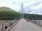
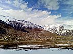
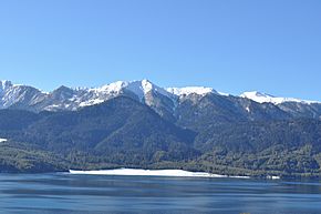
From top going clockwise:Phoksundo lake, Sinja Valley, Simikot, Rara lake, Karnali Bridge and Kanjiroba
|
|
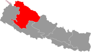
Location of Karnali Pradesh
|
|
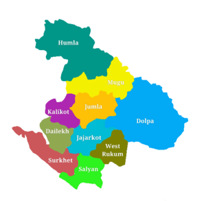
Districts of Karnali Pradesh
|
|
| Country | |
| Formation | 20 September 2015 |
| Capital | Birendranagar |
| Largest city | Birendranagar |
| Districts | 10 |
| Government | |
| • Body | Government of Karnali Pradesh |
| Area | |
| • Total | 24,453 km2 (9,441 sq mi) |
| Area rank | 1st |
| Population
(2011)
|
|
| • Total | 1,570,418 |
| • Rank | 7th |
| • Density | 64.2219/km2 (166.334/sq mi) |
| • Density rank | 7th |
| Demonym(s) | Karnali/Karnalese |
| Time zone | UTC+5:45 (NST) |
| Geocode | NP-SI |
| Main Official Language | Nepali (96.47%) |
| Other Official Language(s) | 1. Magar (1.1%) 2. Tamang (0.9%) |
| HDI | 0.469 (low) |
| Literacy | 62.77% |
| Sex ratio | 95.78 ♂ /100 ♀ (2011) |
| Website | www.karnali.gov.np |
Karnali Province (Nepali: कर्णाली प्रदेश) is one of the seven main areas, or 'provinces,' in Nepal. It covers a large area of about 24,453 square kilometers (9,441 square miles). In 2011, about 1.57 million people lived here.
It was first called Province No. 6. But in February 2018, the local government decided to name it Karnali Province. This province shares borders with the Tibet Autonomous Region of China to the north. To the east, it borders Gandaki Pradesh, and to the west, Sudurpashchim Pradesh. To the south, it borders Province No. 5. The capital city of Karnali Province is Birendranagar.
Contents
Geography of Karnali Province
Karnali is the largest province in Nepal by land area. It covers about 24,453 square kilometers (9,441 square miles). Even though it's the biggest, it has the smallest population among all the provinces. About 1.7 million people live here.
The province is surrounded by other areas. To the east is Gandaki Pradesh. To the south and southeast is Province No. 5. Province No. 7 is to the west. And to the north, it borders the Tibet Autonomous Region in China.
Mountains and Natural Wonders
Karnali Province has tall mountains in the north and mid-hills in the middle. You can find famous mountains like Kubi Gangri, Changla, and Kanjiroba here.
The Shey Phoksundo National Park is located in this province. It is the largest national park in Nepal. Inside the park, you can find the beautiful Phoksundo Lake. Rara Lake, which is the biggest lake in Nepal, is also in Karnali Province.
The Karnali River is the largest river in the province. Many people believe it is the longest river in all of Nepal. Other important rivers like the Seti River and Bheri River flow into the Karnali River. These are called its tributaries.
Government and How Karnali is Run
The head of Karnali Province is called the Governor. The current Governor is Durga Keshar Khanal. The Chief Minister is in charge of the provincial government. Currently, the Chief Minister is Mahendra Bahadur Shahi.
The main court in the province is the Surkhet High Court. Its head is the Chief Judge, who is Hari Kumar Pokharel. The province has 40 seats in its provincial assembly. It also has 12 seats in the national House of Representatives.
Like other provinces in Nepal, Karnali has a unicameral legislature. This means it has one main law-making body. The people elected to the provincial assembly serve for five years.
Districts and Local Areas
Karnali Province is divided into ten smaller areas called districts. Each district is managed by a head from the District Coordination Committee and a District Administration Officer.
These districts are further split into municipalities (cities) or rural municipalities (countryside areas). Karnali Province has 25 municipalities and 54 rural municipalities.
Here are the ten districts of Karnali Province:
- Dailekh District
- Dolpa District
- Humla District
- Jajarkot District
- Jumla District
- Kalikot District
- Mugu District
- Salyan District
- Surkhet District
- Western Rukum District
Related pages
See also
 In Spanish: Provincia de Karnali para niños


