Sudurpashchim Province facts for kids
Quick facts for kids
Sudurpashchim Province
सुदूर-पश्चिम प्रदेश
|
||
|---|---|---|
|
Clockwise from top
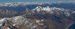
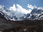
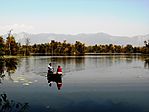
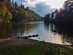
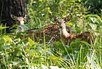
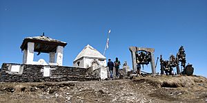
Saipal, Ghodaghodi Lake, Swamp deer at Shuklaphanta National Park, Badimalika Temple, Khaptad Lake, Api Himal |
||
|
||
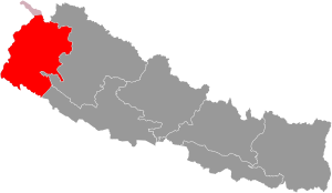
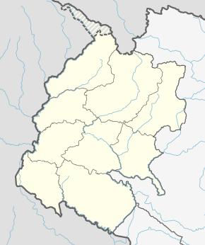
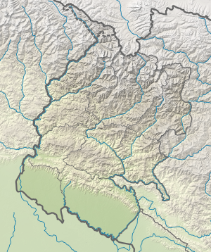
Location of Sudurpashchim Province
|
||
|
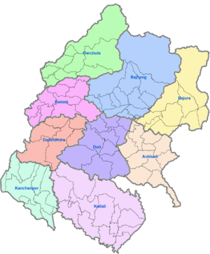
Divisions of Sudurpashchim Province
|
||
| Country | ||
| Formation | 20 September 2015 | |
| Capital | Godawari | |
| Largest city | Dhangadhi | |
| Districts | 9 | |
| Government | ||
| • Type | Self governing province | |
| • Body | Government of Sudurpashchim Province | |
| Area | ||
| • Total | 19,515.52 km2 (7,534.98 sq mi) | |
| Area rank | 6th | |
| Population
(2021)
|
||
| • Total | 2,711,270 | |
| • Rank | 5th | |
| • Density | 138.92891/km2 (359.8242/sq mi) | |
| • Density rank | 5th | |
| Demonym(s) | Sudur Pashchimeli Nepali | |
| Time zone | UTC+5:45 (NST) | |
| Geocode | NP-SE | |
| Official language | Nepali | |
| Other Official language(s) | 1. Doteli 2. Tharu (Rana) |
|
| HDI | 0.478 (low) | |
| Literacy | 76.2% | |
| Sex ratio | 91.25 ♂ /100 ♀ (2011) | |
| GDP | US$2.46 billion | |
| GDP rank | 6th | |
Sudurpashchim Province (Nepali: सुदूरपश्चिम प्रदेश; Far-West Province) is one of the seven provinces in Nepal. It was created on September 20, 2015, when Nepal adopted its new constitution. This province is located in the far western part of the country.
Sudurpashchim Province shares borders with the Tibet Autonomous Region of China to the north. To the east, it borders Karnali Province and Lumbini Province. To the west and south, it borders India's Uttarakhand and Uttar Pradesh states. The province covers an area of about 19,539 square kilometers. This is about 13.22% of Nepal's total land area.
At first, this area was known as Province No. 7. In September 2018, the local government decided to name it Sudurpashchim Province. The city of Godawari was chosen as the permanent capital. However, Dhangadhi is currently serving as the temporary capital. The three biggest cities in the province are Dhangadhi, Bhimdutta (Mahendranagar), and Tikapur.
Contents
What's in a Name?
Sudurpashchim Province was once a "development region" of Nepal. It had the same land area as it does now. Its official name was the Far-Western Development Region. This name was given because it is located at the very western end of Nepal. "Sudurpashchim" is the Nepali word for "Far-Western region."
A Look at History
The history of Sudurpashchim Province is quite old. It was once home to the Doti kingdom. This kingdom formed around the 13th century. It came about after the larger Katyuri Kingdom of Kumaon broke apart. The Katyuri Kingdom was divided into eight smaller kingdoms for its eight princes. Doti was one of these independent kingdoms.
Later, the Raikas, who were rulers from the Katyuri family, took control of the land. This land stretched from the Ramganga River in the west to the Karnali River in the east. The Raikas became very powerful in the Far Western Region and Kumaon.
Challenges from Outside
During the 16th century, the Mughals tried to invade the Raika kingdom of Doti. The Mughal army, led by Hussain Khan, attacked Ajemeru. Ajemeru was the capital of the Raika Kingdom. It is now located in Dadeldhura District in Nepal. The Mughals were interested in the kingdom's wealth. However, they did not succeed in taking over the region.
Later, in 1790, the Doti Kingdom faced a conflict with the Gorkha kingdom (which later became Nepal). This happened during the Gorkha expansion. The war took place near the Seti River.
Geography and Landscape
Sudurpashchim Province covers 19,539 square kilometers. This is about 13.27% of Nepal's total area. The province has different types of land:
- Mountains: About 40.60% of the area (7,932.834 sq km) is mountainous.
- Hills: About 34.54% of the area (6,748.7706 sq km) is hilly.
- Terai (Plains): About 24.86% of the area (4,857.3954 sq km) is flat plains.
This means the province has more mountains and hills than flat land. It is located in the far western part of Nepal.
Districts and Rivers
The province is divided into nine districts. Two districts, Kailali and Kanchanpur, are in the flat Terai region. Four districts, Doti, Dadeldhura, Achham, and Baitadi, are in the hilly region. The remaining three districts, Darchula, Bajhang, and Bajura, are in the high Himalayan region.
Important rivers flow through this province. The Karnali River is in the east. The Seti River flows through the middle. The Mahakali River is in the west.
Towering Mountains
The province is home to some impressive mountains. Mt. Api stands at 7,132 meters (about 23,399 feet). Mt. Saipal is 7,025 meters (about 23,048 feet) tall. These are the main mountain peaks in Sudurpashchim Province.
How the Government Works
The government of Sudurpashchim Province has different leaders.
- The Governor is like the head of the province.
- The Chief Minister is the head of the provincial government.
- The Chief Judge of the Dipayal High Court leads the justice system.
The province has a single legislative body, meaning it has one main assembly that makes laws. This is called the Provincial Assembly of Sudurpashchim Province. It has 53 members. These members are elected for five years. The Provincial Assembly currently meets in Dhangadhi.
Dividing the Province
Sudurpashchim Province is divided into nine main areas called districts. Each district is managed by a special committee and an officer. These districts are then further divided into smaller areas. These smaller areas are either:
- Municipalities: There is one sub-metropolitan city and 33 other municipalities.
- Rural Municipalities: There are 54 rural municipalities.
Here are the nine districts:
- Achham District
- Baitadi District
- Bajhang District
- Bajura District
- Dadeldhura District
- Darchula District
- Doti District
- Kailali District
- Kanchanpur District
Important Roads and Education
Connecting Places with Roads
Highways connect all nine districts of Sudurpashchim Province. The Mahakali Highway and Seti Highway are the most important roads. The Mahakali Highway links the flat Terai region with the hilly areas of the province. It also connects major trade centers like Dhangadhi and Attariya.
Learning and Literacy
Education is important in Sudurpashchim. In 2021, the literacy rate (the percentage of people who can read and write) was 76.2%. This means that most people in the province can read and write. More males (83.6%) are literate than females (69.4%).
People and Languages
Ethnicities/castes of Sudurpashchim Pradesh Chhetri (44.09%) Tharu (17.15%) Hill Brahmin (11.90%) Kami (7.22%) Thakuri (4.40%) Damai (2.56%) Magar (2.18%) Sarki (1.67%) Lohar (1.17%) Sanyasi (1.01%) Other Khas Dalit (3.15%) Others (2.5%)
In 2011, the province had a population of 2,552,517 people. This was about 9.63% of Nepal's total population. There were more females than males. For every 1000 females, there were about 912 males. Most people (58.9%) live in urban areas, while 41.1% live in rural areas.
Who Lives Here?
The largest group of people in Sudurpashchim are the Khas/Chhetri, making up 44.09% of the population. The Tharu are the second largest group, at 17.15%. Other groups include Hill Brahmin, Kami, Thakuri, Damai, Sarki, Lohar, and Sanyasi. There are also some Magars.
What Languages Are Spoken?
Languages of Sudurpashchim Province (2011) Doteli (30.45%) Nepali (30.18%) Tharu (17.01%) Baitadeli (10.65%) Achhami (5.58%) Bajhangi (2.64%) Others (3.49%)
Many people in the province speak languages that are similar to Nepali. The main language spoken in the central part of the province is Doteli. In the eastern parts, dialects like Bajauri and Achhami are spoken.
The Tharu language is spoken by many people in the Terai region. This language has been influenced by Nepali and Hindi. There are also a few speakers of the Magar and Byangsi languages in the higher mountain areas.
The Language Commission of Nepal has suggested that Dotyali and Tharu should be official languages in the province. They also recommended Baitadeli, Achhami, and Bajhangi as additional official languages for specific areas.
Religions in the Province
Religion in Sudurpashchim Province Hinduism (97.23%) Christianity (1.09%) Buddhism (1.07%) Islam (0.23%) Prakṛti (0.22%) Other or not religious (0.16%)
Most people in Sudurpashchim Province follow Hinduism, making up 97.23% of the population. Other religions practiced include Christianity (1.09%), Buddhism (1.07%), and Islam (0.23%).
Major Cities
|
Largest cities or towns in Sudurpashchim Province
Central Bureau of Statistics [1] |
||
|---|---|---|
| Rank | Pop. | |
| 1 | Dhangadhi | 147,741 |
| 2 | Mahendranagar | 104,599 |
| 3 | Godawari | 78,018 |
| 4 | Tikapur | 76,984 |
| 5 | Ghodaghodi | 75,586 |
| 6 | Lamki Chuha | 75,425 |
| 7 | Krishnapur | 56,643 |
| 8 | Gauriganga | 55,314 |
| 9 | Punarbas | 53,633 |
| 10 | Belauri | 53,544 |
See also
 In Spanish: Provincia de Sudurpashchim para niños
 | Chris Smalls |
 | Fred Hampton |
 | Ralph Abernathy |


