Far-Western Development Region, Nepal facts for kids
Quick facts for kids Far-Western Development Region, Nepal (सुदुर पश्चिमाञ्चल - Sudura Paścimāñcala) |
|
| Region | |
|
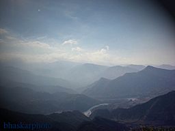
The Seti River valley with Dipayal on the left
|
|
| Country | |
|---|---|
| Zones | Mahakali, Seti |
| Headquarters | Dipayal Silgadhi |
| Area | 19,539 km² (7,544 sq mi) |
| Population | 2,552,517 (2011) |
| Density | 131 /km² (339 /sq mi) |
| Timezone | NPT (UTC+5:45) |
| ISO 3166-2 | NP-5 |
The Far-Western Development Region (in Nepali: सुदुर पश्चिमाञ्चल विकास क्षेत्र - Sudur Pashchimānchal Bikās Kshetra) was one of Nepal's five main development regions. It was located at the very western end of the country. Its main office, or headquarters, was in Dipayal Silgadhi.
Contents
Where is the Far-Western Region?
This region was bordered by different areas. To its east was the Mid-Western Development Region. To the south, it shared a border with Uttar Pradesh in India. On its western side was Uttarakhand, also in India. To the north, it touched the Tibet Autonomous Region in China.
It was the smallest of Nepal's development regions. It covered an area of about 19,539 square kilometers (7,544 sq mi). It also had the lowest population among the regions, with 2,552,517 people living there. This meant it had about 130.6 people per square kilometer.
Land and Nature
The Far-Western Development Region was home to some impressive mountains. The highest mountain in this region was Api Peak. It stood tall at 7,132 meters (23,399 ft) and was located in the Darchula district. Another very high mountain was Saipal, which was 7,031 meters (23,068 ft) high. Saipal is found in the Bajhang district.
Two of the most important rivers in this region were the Seti and the Mahakali rivers. The Mahakali River is also known as the Sharda River in India. Both of these rivers flow into the Karnali river, which is a very large river system.
Important Cities
The biggest city in the Far-Western Development Region was Mahendranagar. It was the eighth largest city in all of Nepal. Mahendranagar is located very close to the border with India, only about 5 kilometers (3.1 mi) away.
Other important cities in this region included Dipayal Silgadhi, Dhangadhi, and Baitadi. These cities served as important centers for the people living in the region.
How the Region was Divided
The Far-Western Development Region was split into two main parts called Zones. These zones then contained a total of nine smaller areas called Districts.
Here's a simple look at how it was divided:
- Mahakali Zone
- This zone had a population of 977,514 people in 2011.
- It covered an area of 6,989 square kilometers.
- It included 4 districts: Baitadi, Dadeldhura, Darchula, and Kanchanpur.
- Seti Zone
- This zone had a population of 1,575,003 people in 2011.
- It covered an area of 12,550 square kilometers.
- It included 5 districts: Achham, Bajhang, Bajura, Doti, and Kailali.
In total, the Far-Western Development Region had 2,552,517 people and 9 districts across its two zones.
Related Information
 | Ernest Everett Just |
 | Mary Jackson |
 | Emmett Chappelle |
 | Marie Maynard Daly |


