Karnare Col facts for kids
Karnare Col (which means 'Karnare Saddle' in Bulgarian, written as Bulgarian: седловина Кърнаре) is a narrow, rocky pass in Antarctica. It sits high up, about 2,100 meters (or 6,890 feet) above sea level. This col connects two important areas: the southeast side of Mount Craddock and the northeast ridge of Mount Strybing. It also links the Craddock Massif to Owen Ridge.
This special place is found in the southern part of the Sentinel Range, which is part of the Ellsworth Mountains in Antarctica. Karnare Col stretches about 1.7 kilometers (or 1.1 miles) from east to west and has a lower area on its eastern side. It acts like a natural dividing line for glaciers, separating the Nimitz Glacier from the Rutford Ice Stream. From here, you can look down at the Severinghaus Glacier to the southwest and the Saltzman Glacier to the northeast.
The name 'Karnare Col' comes from a small town called Karnare in Southern Bulgaria.
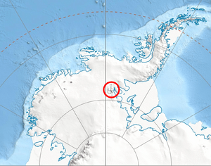
Where is Karnare Col Located?
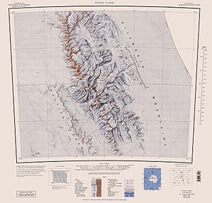
Karnare Col is precisely located at 78°38′50″S, 85°07′32″W. The United States first mapped this area in 1961, and then updated their maps in 1988.
 | Bessie Coleman |
 | Spann Watson |
 | Jill E. Brown |
 | Sherman W. White |


