Katama Airpark facts for kids
Quick facts for kids
Katama Airpark
|
|||||||||||||||||||
|---|---|---|---|---|---|---|---|---|---|---|---|---|---|---|---|---|---|---|---|
| Summary | |||||||||||||||||||
| Airport type | Public | ||||||||||||||||||
| Operator | Town of Edgartown | ||||||||||||||||||
| Location | Edgartown, Massachusetts | ||||||||||||||||||
| Elevation AMSL | 18 ft / 5 m | ||||||||||||||||||
| Coordinates | 41°21′30.4220″N 70°31′28.09″W / 41.358450556°N 70.5244694°W | ||||||||||||||||||
| Website | http://katamaairfield.com/ | ||||||||||||||||||
| Map | |||||||||||||||||||
| Runway | |||||||||||||||||||
|
|||||||||||||||||||
| Statistics (2006) | |||||||||||||||||||
|
|||||||||||||||||||
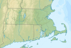
Katama Airpark (airport code 1B2) is a public airport located in the Katama area of Edgartown, Massachusetts. It's found on the beautiful island of Martha's Vineyard. The town of Edgartown owns this airport.
Katama Airpark has three runways, which are grassy fields where planes take off and land. On average, about 22 planes arrive or depart each day. Around four aircraft are regularly kept at this airfield.
This airport is one of three on Martha's Vineyard. The main airport, Martha's Vineyard Airport (MVY), offers commercial flights. It also handles most of the island's private plane traffic. The third airport is the smaller Trade Wind Airport in Oak Bluffs, which also has a grass runway.
Contents
A Look Back: Katama Airpark's History
During World War II, Martha's Vineyard played an important role. Its main airport helped defend the coast and trained pilots. There was also a small airfield at Katama, close to a gunnery practice area by the beach.
After the war, Steven Gentle bought this airfield. He managed Katama Airpark until the 1980s. At that time, the state bought the airport using conservation funds. This was done to protect five types of endangered plants and animals living there.
What You'll Find: Airport Facilities
The town of Edgartown manages Katama Airpark. If you visit during the summer season (usually from May 31 to Labor Day), you can find some exciting activities.
- You can take rides in a biplane, which is an old-fashioned plane with two sets of wings.
- Glider rides are also available, where you fly without an engine.
- If you're interested in learning to fly, flight instruction is offered using four different types of aircraft.
Dining at the Airpark
Right next to the airfield, there's a restaurant called "The Right Fork Diner." Before it got its current name, it was known as "Mels." It was renamed after the person it was named after retired.
Ocean Research Nearby
The Woods Hole Oceanographic Institute has a small building next to the airplane hangar. This building is used for monitoring important data. It tracks things like how waves move, how the beach is affected by erosion, and wave action further out in the ocean. This building is not open to the public.
- Resources for this airport:
- FAA airport information for 1B2
- AirNav airport information for 1B2
- FlightAware airport information and live flight tracker
- SkyVector aeronautical chart for 1B2
- AOPA airport information for 1B2
 | Bayard Rustin |
 | Jeannette Carter |
 | Jeremiah A. Brown |


